
| Holiday 1999 in Pakistan, China, Tibet and Nepal |
|
Pakistan is dry and warm in summer, with temperatures above 35 degrees Celcius. From July
to September there is the monsoon in the south and middle part of the country. Storms are
not rare during this period. The north part of Pakistan is mountainous and less warm.
Karimabad is even in summer cooler and dryer. In September it can be a bit cold during
the night. In China we traveled through the provinces Xinjiang, Gansu and Qinghai. These parts all have a desert climate. This means an extreme warm and dry summer, a short autumn and spring and very cold winters. In July and August temperatures in Kashgar rise above 35 ºC. In September it is between 20 and 25 ºC in the daytime. At night at can be quite cold. In winter daytemperatures below -15 ºC are normal. Tibet has a dry mountain climate due to the high altitude. In summer you can walk around in a T-shirt, but in the shade the temperature drops fast. In the evening you'll probably wear a sweater or a fleece. At the end of the summer some rain may fall. When there is snow high in the mountains it can be very cold. Because Nepal has altitudes between 150 and 8800 meter the climate can be subtropical on the planes but also cold in the mountains. There are only two seasons in Nepal. The dry season is from October to May and the monsoon from June to September. In summer the temperature lies around 30 ºC. In autumn it is still above 20 ºC. When it rains in Nepal it does not rain all day. Usually it lasts for about two hours and then the sun will shine again. |
R=average number of days with rain (1 mm or more) |
|||||||||||||||||||||||||||||||||||||||||||||||||||||||||||||||||||||||||||||||||||||||||||||||||
 Pakistan ("the land of the pure" in Urdu) is the land of the Indus River. In 1947 the
country was formed, after it was proposed to form a separate state for muslim. The result
was a migration of 6 million people. At this moment there are 120 million people living
in Pakistan.
Pakistan ("the land of the pure" in Urdu) is the land of the Indus River. In 1947 the
country was formed, after it was proposed to form a separate state for muslim. The result
was a migration of 6 million people. At this moment there are 120 million people living
in Pakistan.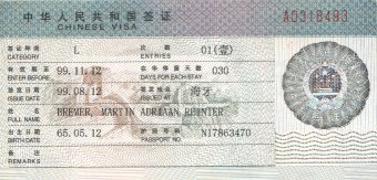 The Chinese have one of the world's oldest civilizations. Human remains found in China
date back hundreds of thousands of years. Rice was first grown in eastern China around
5500 BC, and about 500 years later an agricultural society developed in the valleys of
the Huang He.
The Chinese have one of the world's oldest civilizations. Human remains found in China
date back hundreds of thousands of years. Rice was first grown in eastern China around
5500 BC, and about 500 years later an agricultural society developed in the valleys of
the Huang He.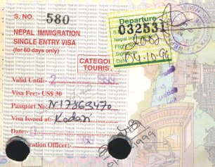 The fertile Kathmandu Valley is densely populated. Most people live in rural
settlements near water sources, and few towns have more than 10,000 inhabitants.
Many groups move from one elevation to another to take advantage of the seasonal
changes in weather most favourable to growing crops and raising livestock. Others,
especially in mountainous districts, periodically go to India for temporary
employment, to purchase supplies, and to trade. The main ethnic group, the Newars,
were probably the original inhabitants of the Kathmandu Valley. There are also
various Tibetan-Burmese groups, such as the Gurung, Magar, Rai, Limbu, Thakali,
and Sherpa, who have migrated to Nepal over millennia. Some other major groups,
such as the Tharu, are of mixed origin. Indians and Tibetans also live in Nepal.
The fertile Kathmandu Valley is densely populated. Most people live in rural
settlements near water sources, and few towns have more than 10,000 inhabitants.
Many groups move from one elevation to another to take advantage of the seasonal
changes in weather most favourable to growing crops and raising livestock. Others,
especially in mountainous districts, periodically go to India for temporary
employment, to purchase supplies, and to trade. The main ethnic group, the Newars,
were probably the original inhabitants of the Kathmandu Valley. There are also
various Tibetan-Burmese groups, such as the Gurung, Magar, Rai, Limbu, Thakali,
and Sherpa, who have migrated to Nepal over millennia. Some other major groups,
such as the Tharu, are of mixed origin. Indians and Tibetans also live in Nepal.
Day 2: Arrival in Rawalpindi
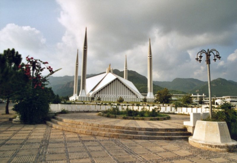 Rawalpindi is close to Islamabad, the capital of Pakistan. Here we visited the Shah Faisal
mosque, a very large and modern building. With the help of some locals we got the taxi ride
cheap. Unfortunately we were not allowed to go into the building, but we did walk on the
large square next to it. Remember to take off your shoes and were proper clothing.
Rawalpindi is close to Islamabad, the capital of Pakistan. Here we visited the Shah Faisal
mosque, a very large and modern building. With the help of some locals we got the taxi ride
cheap. Unfortunately we were not allowed to go into the building, but we did walk on the
large square next to it. Remember to take off your shoes and were proper clothing.
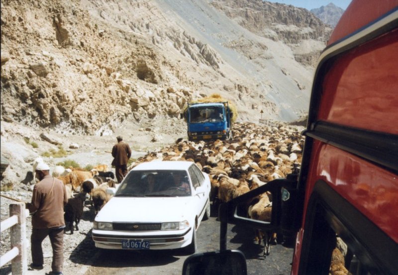
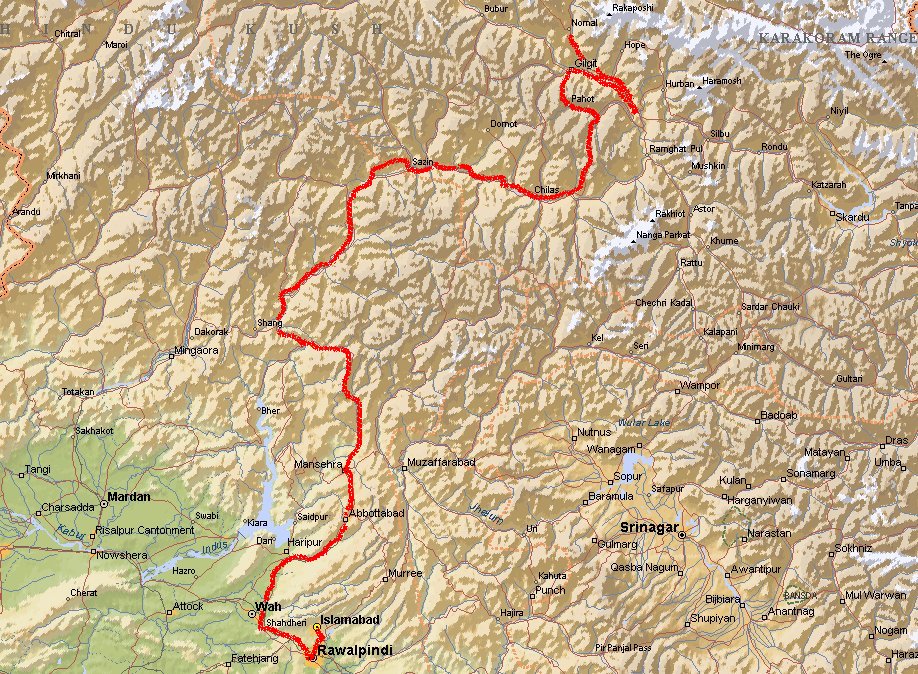
Day 3: Rawalpindi - Gilgit
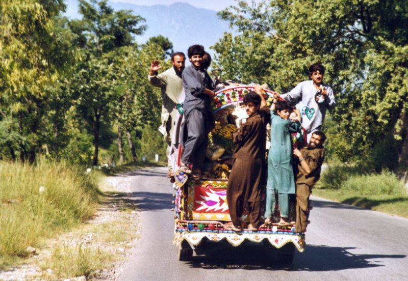 Driving through small towns you'll see many things. People working on the fields, market
places were a lot of fruit is available, animals on the road. While I was taking a picture
of men hanging on a truck with fruit, they were very amused. One guy took some banana's
and pointed out that I could have them if I opened the window. So I did. With a speed of
at least 70 km/h he handed them to me.
Driving through small towns you'll see many things. People working on the fields, market
places were a lot of fruit is available, animals on the road. While I was taking a picture
of men hanging on a truck with fruit, they were very amused. One guy took some banana's
and pointed out that I could have them if I opened the window. So I did. With a speed of
at least 70 km/h he handed them to me.

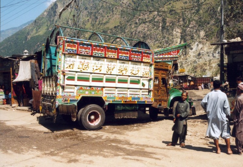 Most trucks and buses are painted in bright colors and decorated with lots of little things.
Even the small Suzuki's are like that. As you go north along the Karakoram Highway the
vegetation changes dramatically. The terrain becomes more rugged and roads get worse.
Most trucks and buses are painted in bright colors and decorated with lots of little things.
Even the small Suzuki's are like that. As you go north along the Karakoram Highway the
vegetation changes dramatically. The terrain becomes more rugged and roads get worse.
Day 4: Gilgit - Karimabad
 Gilgit used to be an important town along the Silk road. You'll still find many different
cultures here: Afghan, Chinese, Indian and Pakistan.
Gilgit used to be an important town along the Silk road. You'll still find many different
cultures here: Afghan, Chinese, Indian and Pakistan.
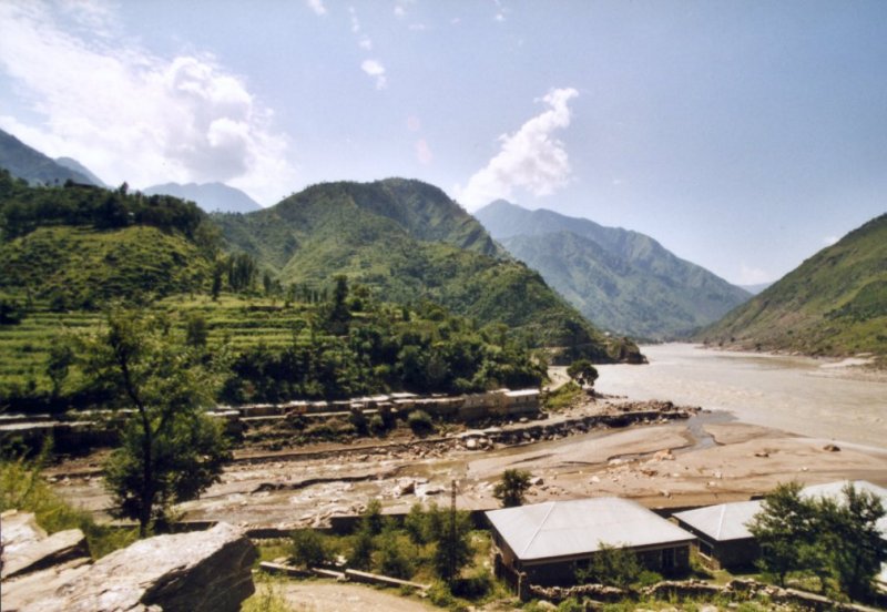
On this day we see the Indus river, the holy river. In this area the Indian continent is
crashing into the Asian plateau. The mountains here grow 7 millimeters per year.
 For lunch we buy the local bread (Naan) which was made while we were waiting. You can't get
it better then this. When it is still warm it tasts the best. On the photo you can see our local guide Jan on the right.
For lunch we buy the local bread (Naan) which was made while we were waiting. You can't get
it better then this. When it is still warm it tasts the best. On the photo you can see our local guide Jan on the right.
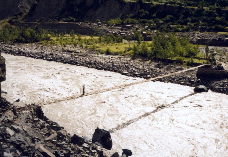
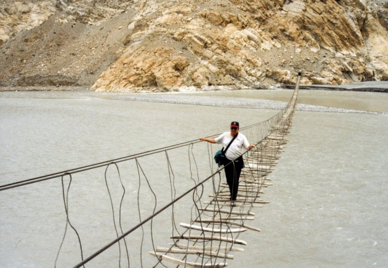
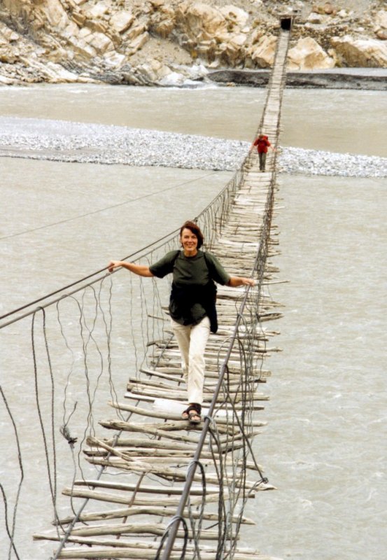
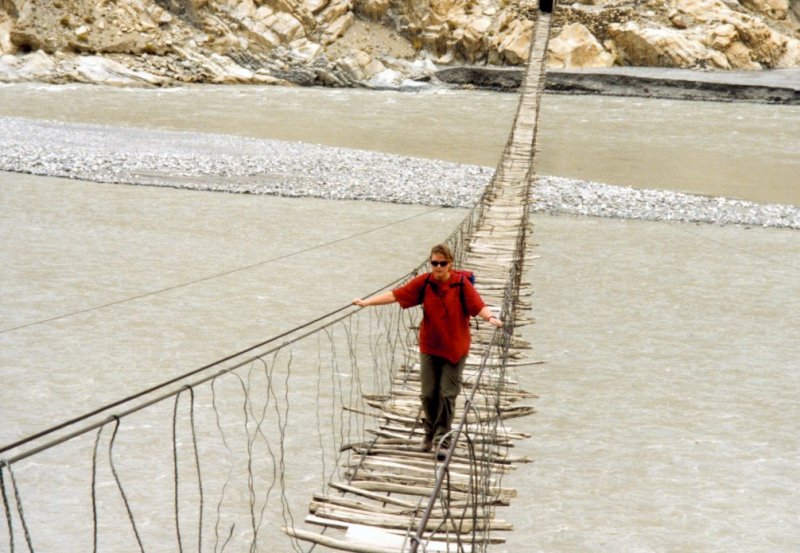
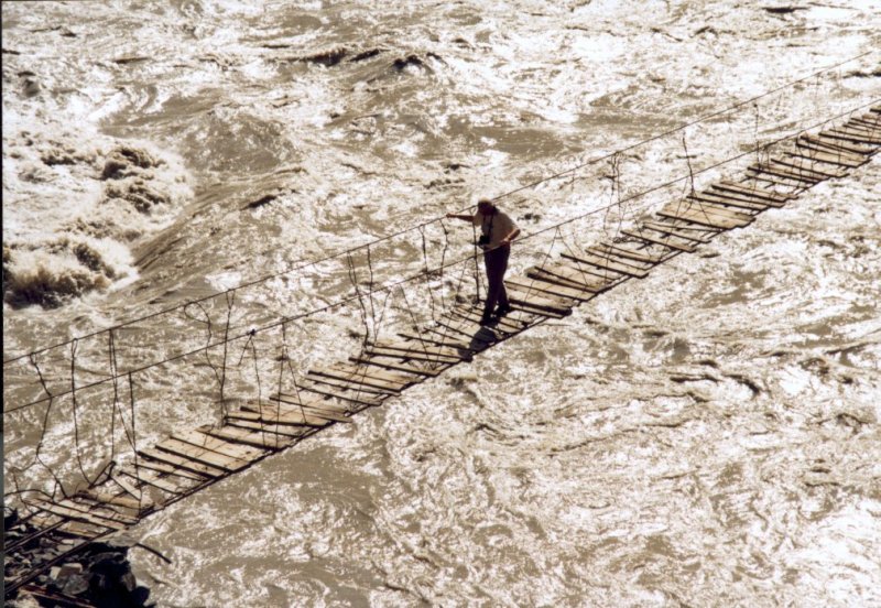 Rope bridges are very spectacular. Here you see Rien walking on it. You have to do this
carefully, because the fast moving water underneath distracts you easily. After I made
the full trip to the other side, the rest of the group followed.
Rope bridges are very spectacular. Here you see Rien walking on it. You have to do this
carefully, because the fast moving water underneath distracts you easily. After I made
the full trip to the other side, the rest of the group followed.
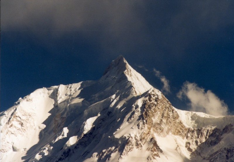 Unfortunately we missed the sight of the Nanga Parbat (8125 m.), because we drove at night
when we passed it. But we have seen the Rakaposhi (7788 m.) in full glory.
Unfortunately we missed the sight of the Nanga Parbat (8125 m.), because we drove at night
when we passed it. But we have seen the Rakaposhi (7788 m.) in full glory.
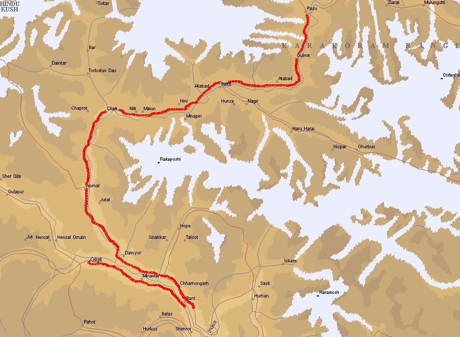
Day 5/6: Hunza valley
Karimabad is the capital of the former kingdom Hunza. Until 1974 a feudal mir ruled
here. One of the myths in the valley is that people here get very old because they eat
a lot of dried fruit like apricots.
During a hike near Passu (very spectacular rope bridges over the Hunza river) I got my
first experience with mountain sickness. I had great difficulties with breathing, couldn't
think straight and realized this! Without hesitating I gave my camera equipment to one of
the women when she offered me to carry it. Normally I would have said no, but I said yes without
thinking.
Although I was at an altitude of only 2400 m. I
later realized that I didn't drink enough and the temperature was quite high. Dehydration
caused by diarrhoea also did me no good. After one-third of the trip we decided to go back.
Every step became more difficult. The last climb I'll never forget. Some helpful Pakistani
offered me water and took me by the hands to help me walking. We drove to the nearest restaurant
where I got some tea. After 30 to 45 minutes I was breathing normal again. Later we also drank
some mountain tea (made out of a stimulating plant like marihuana).
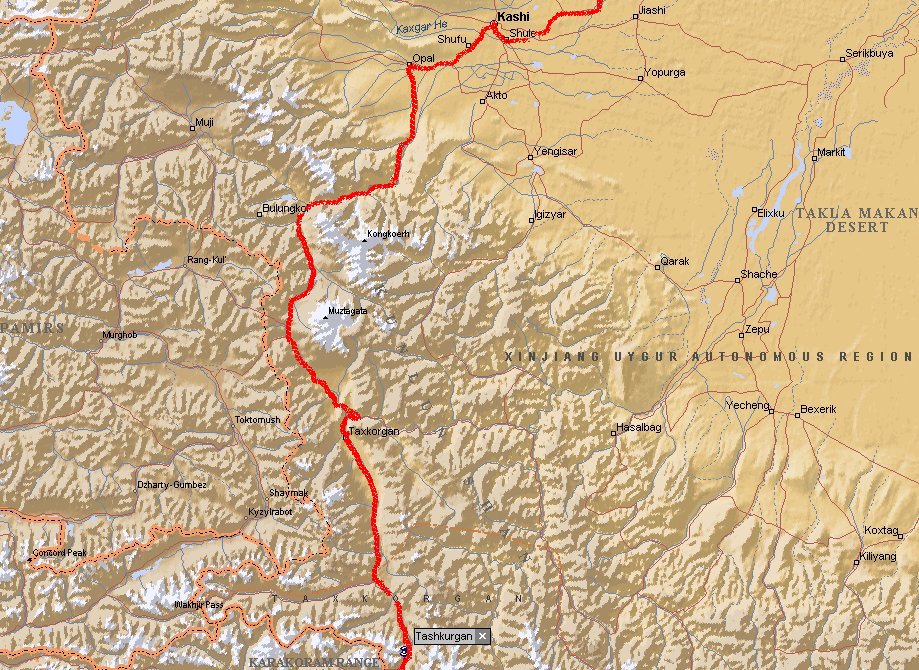
Day 7: Karimabad - Tashkurgan
Also this was a day to remember. The previous day I experienced some mountain sickness at
low altitude. This day looked like the worst day in my life. I had the same problems, but this
time at high altitude. We were crossing the Kunjerab Pass (4900 m.) and basically got most of
the phenomena: dizzyness, I couldn't walk normal, short of breath, no production of urine.
I almost came to a point where I had to vomid and lost control of my intestines. People in
my group later said I looked gray and terrible. I never felt so sick in my life. When we
passed the border with China I could not even fill in my registration form. I just sat down
on the ground in apathy. The group leader took me by the hand and together we went to the customs
office. Without my luggage I passed the border. They didn't even check me, because it was
also obvious for the Chinese customs that I had a problem. In Tashkurgan (3300 m.) I went
straight to bed when we arrived at the hotel. The next morning things were back to normal.
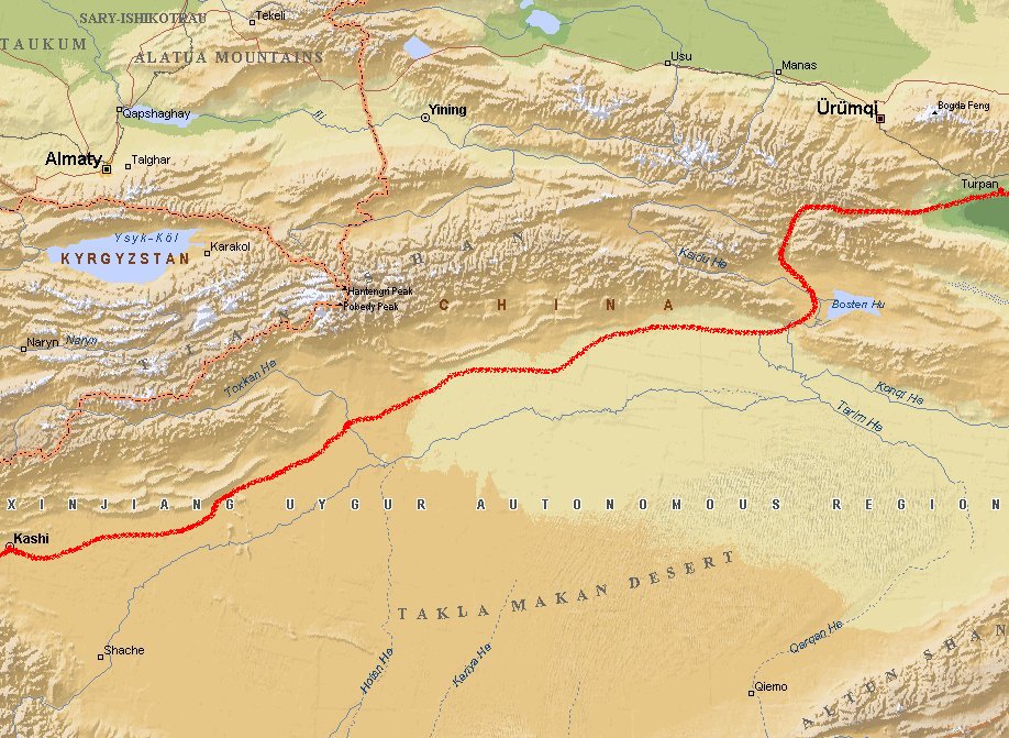
Day 8: Tashkurgan - Kashgar
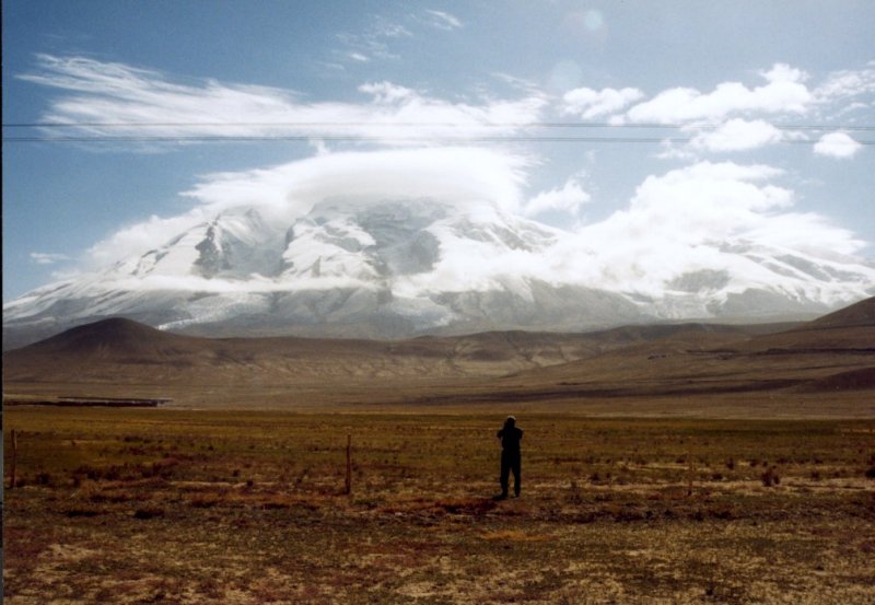
 On this part of the journey you'll drive between the high mountains of the Pamir and the
empty desert of Taklamakan. Not many people are living here. Sometimes you'll see Tibetan
or Tadjikan nomads with sheep, yak or camels.
On this part of the journey you'll drive between the high mountains of the Pamir and the
empty desert of Taklamakan. Not many people are living here. Sometimes you'll see Tibetan
or Tadjikan nomads with sheep, yak or camels.
Day 9/10: Kashgar (Kashi)
 Kashgar used to be an important city along the Silk Road. Nowadays it is the center of
local trade. Many things are made at the side of the road or in little shops. Clothing,
furniture, musical instruments, pots and pans. Although the kebab smelled very good I did't
dare to eat it.
Kashgar used to be an important city along the Silk Road. Nowadays it is the center of
local trade. Many things are made at the side of the road or in little shops. Clothing,
furniture, musical instruments, pots and pans. Although the kebab smelled very good I did't
dare to eat it.
There are about 100 mosque's in Kashgar. The largest is the Id Kah mosque. The square and the
street around it are very nice. Also in the evening you'll see lots of activities here. Many
shops have a TV where a kung-fu movie is playing. You gotta see this.
On sunday there is a big market near the river. Thousands of farmers and merchants come there
to sell and buy horses, donkeys, sheep and goats. It starts at 7 in the morning.
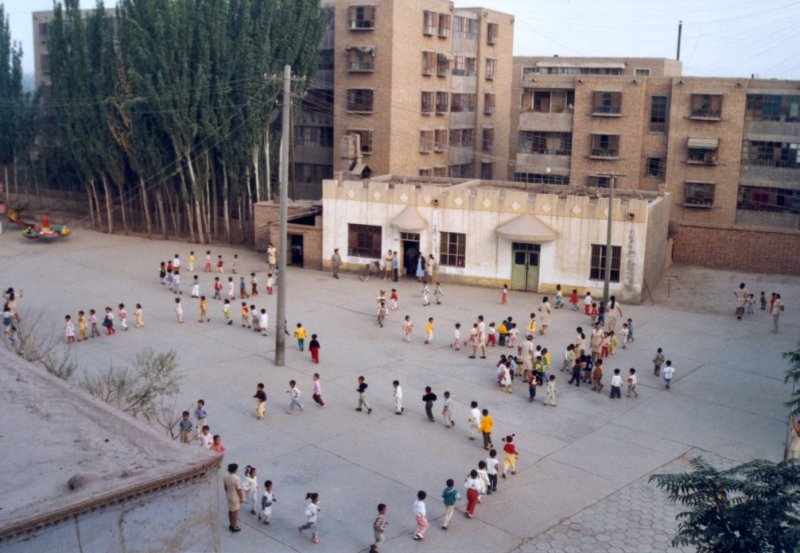
On monday morning we woke up at 8 o'clock, because there was music outside our hotel. When
we opened the curtains we saw little children on a large square. School was starting and
they started with gymnastics and singing. Very amusing, a square full of children and
the teachers are the most enthousiastic ones. And there are always a few children who
don't like it.
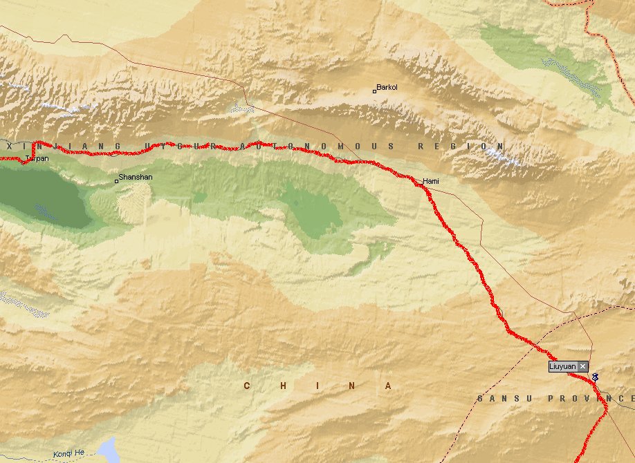
Day 11/12/13: Kashgar - Turpan (Turfan)
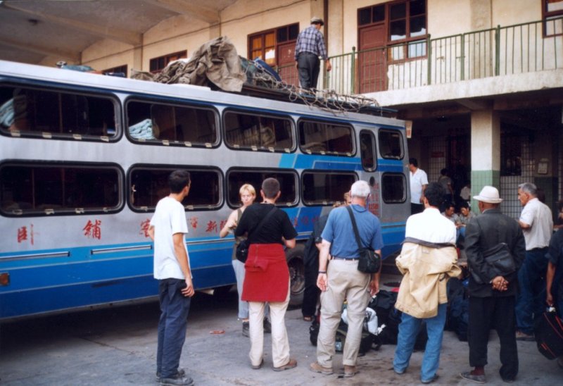 You take the sleeperbus to the oasis of Turpan. It will take about 36 hours to get there.
This was a trip with many obstacles. The first one was the fact that our tourleader
thought she bought
tickets with baggage included. When we were at the busstation this turned out not to be
the case. Our luggage was put on a pair of scales and we had to pay extra money. Then
the driver of the bus was not willing helping us to put the luggage on the roofrack. He said
to our leader "you do it". Bear in mind that our tourlearder is a woman who hasn't got the
figure of a bodybuilder. After yelling and cursing to one of the drivers he did go on top
of the bus after about 10 minutes. After one hour or so the bus stopped and a small repair
was made at the back of the bus. Don't know what it was. Later that evening we got our first
flat tire. The bolts on the wheel were difficult to get off. A lot of violence was used, but
the tire was replaced by a very worn out spare. This didn't look promising. During the night
several stops were made where repairs were done near the engine. Again I don't know what they
were doing. The next day we got a second flat tire. The tire was completely ripped off from
the rim. It was clear that we didn't trust a another spare tire like we had seen before.
So the tourleader said "OK, we paid extra money to get on this bus. Buy a new tire from
this money". And they did. A few hours later a watermelon was stolen from our group. Two
chinese men were later seen eating a melon just like ours. They denied it of coarse, but
we knew better.
You take the sleeperbus to the oasis of Turpan. It will take about 36 hours to get there.
This was a trip with many obstacles. The first one was the fact that our tourleader
thought she bought
tickets with baggage included. When we were at the busstation this turned out not to be
the case. Our luggage was put on a pair of scales and we had to pay extra money. Then
the driver of the bus was not willing helping us to put the luggage on the roofrack. He said
to our leader "you do it". Bear in mind that our tourlearder is a woman who hasn't got the
figure of a bodybuilder. After yelling and cursing to one of the drivers he did go on top
of the bus after about 10 minutes. After one hour or so the bus stopped and a small repair
was made at the back of the bus. Don't know what it was. Later that evening we got our first
flat tire. The bolts on the wheel were difficult to get off. A lot of violence was used, but
the tire was replaced by a very worn out spare. This didn't look promising. During the night
several stops were made where repairs were done near the engine. Again I don't know what they
were doing. The next day we got a second flat tire. The tire was completely ripped off from
the rim. It was clear that we didn't trust a another spare tire like we had seen before.
So the tourleader said "OK, we paid extra money to get on this bus. Buy a new tire from
this money". And they did. A few hours later a watermelon was stolen from our group. Two
chinese men were later seen eating a melon just like ours. They denied it of coarse, but
we knew better.
 During this trip Jan-Frans celebrated his birthday. He got a small musical instrument (now he
could form a band together with Sander who bought an instrument as well). In the bus his bed
was decorated with multi-colored banners.
During this trip Jan-Frans celebrated his birthday. He got a small musical instrument (now he
could form a band together with Sander who bought an instrument as well). In the bus his bed
was decorated with multi-colored banners.
 In Turpan you can visit many places. We went to the Bezelik Grottoes and the Flaming Mountains.
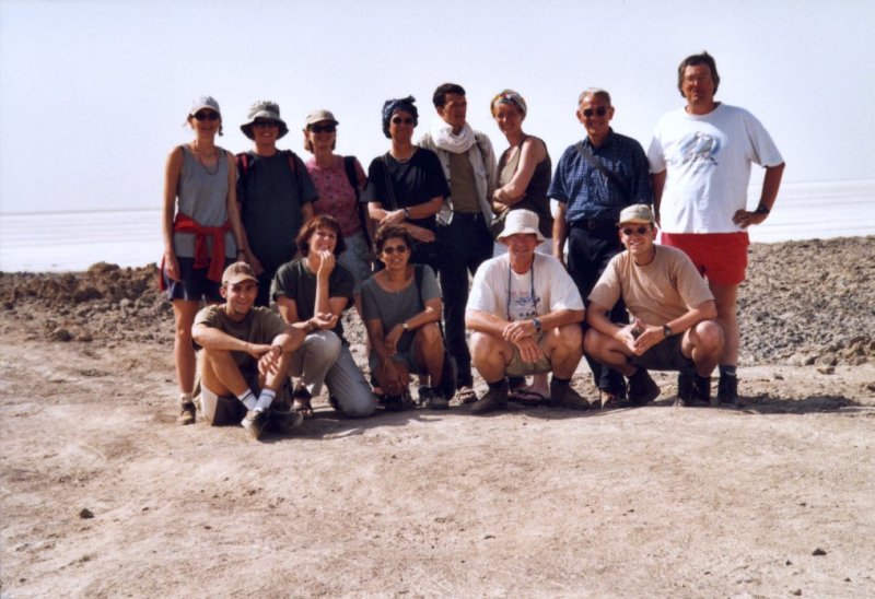
We also went to the second lowest continental point on earth (-152 m.) and the Emin pagode. The picture on the right shows our group at the lowest point in the journey. From left to right you see Monique, Andrea, Karianne, Ria, Marc, Ellen, Pieter and myself. In front are Sander, Margreet, Carmen, Rien and Jan-Frans.
In Turpan you can visit many places. We went to the Bezelik Grottoes and the Flaming Mountains.
We also went to the second lowest continental point on earth (-152 m.) and the Emin pagode. The picture on the right shows our group at the lowest point in the journey. From left to right you see Monique, Andrea, Karianne, Ria, Marc, Ellen, Pieter and myself. In front are Sander, Margreet, Carmen, Rien and Jan-Frans.
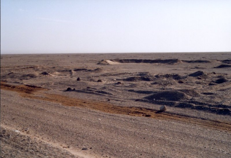 Turpan has an irrigation system (the Karez) that is a few centuries old. Melted
snow from the mountains is transported to the city in underground canals.
In the landscape you can see small craters where they have access to them. Two men are
working here to clean the canals.
You'll also find grapevines, melons and apricots in this area.
Turpan has an irrigation system (the Karez) that is a few centuries old. Melted
snow from the mountains is transported to the city in underground canals.
In the landscape you can see small craters where they have access to them. Two men are
working here to clean the canals.
You'll also find grapevines, melons and apricots in this area.
Day 14: Turpan - Liuyuan
 In the evening we took the bus to Daheyan, about 45 kilometers away from Turpan. This is the
only train station in this area. The road to Dayehan was really bad. At some points the road
was gone due to heavy rainfall. Imagine driving in complete darkness and the only thing that
you see is a road where parts are missing and lots of water flooding the road.
In the evening we took the bus to Daheyan, about 45 kilometers away from Turpan. This is the
only train station in this area. The road to Dayehan was really bad. At some points the road
was gone due to heavy rainfall. Imagine driving in complete darkness and the only thing that
you see is a road where parts are missing and lots of water flooding the road.
At 1.30 am. our train arrived. These trains have so-called hard-sleeper beds. Fortunately
this train was very new and a lot of personnel on board made sure that the train was kept
in that state. After a good rest and 15 hours later we arrived at Dunhuang.
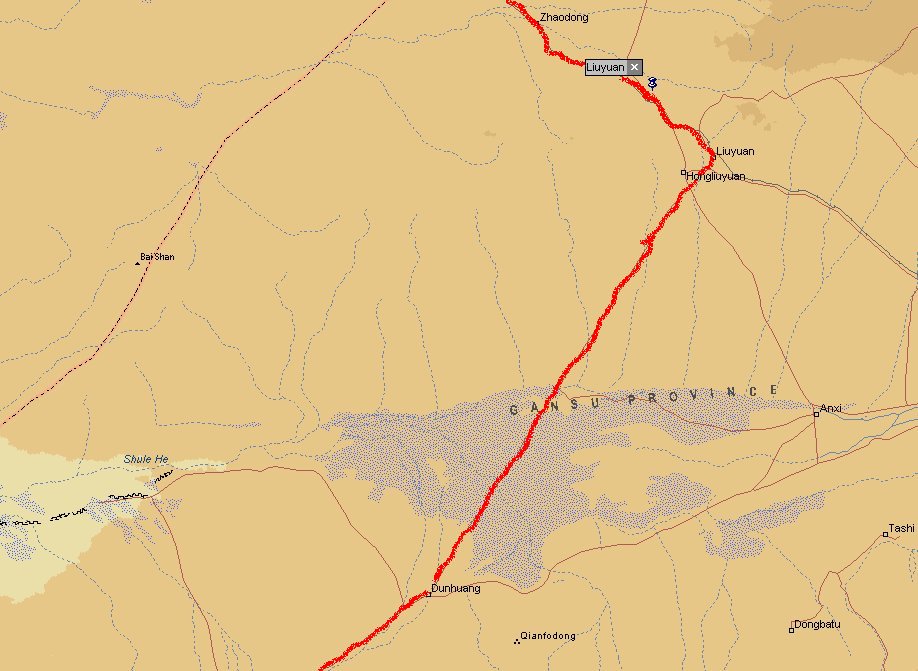
Day 15: Liuyuan - Dunhuang
It takes about two hours driving to Dunhuang. This is the first real chinese looking city
we see. No arabian signs and kebabs along the road. On the markets you can find many kinds
of fruit and vegetables.
Day 16: Dunhuang
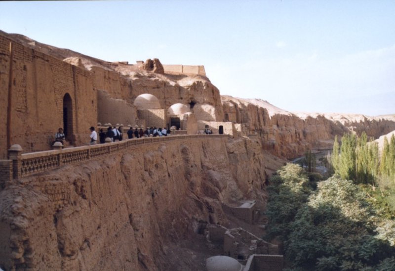
One of the most interesting places to visit are the Mogao Caves. This is one of the best
preserved examples of buddhist art. It is situated 25 kilometers southeast of Dunhuang.
According to inscriptions a monk started with making
sculptures in the caves in the year 366. In the centuries that followed hundreds of caves
were made in the sandstone mountains. They stopped making new caves in the 14th century.
Today 492 caves survived the natural collapses, human pillages and the manmade
destructions as well, with more than 45,000 square meters of wallpaintings, 2,000 odd
painted clay scultures, five timber structures belonging to the Tang and Song Dynasties
as well as several tens of thousand of manuscripts, documents and art objects discovered
in cave no.17. In 1987 the caves were list as an important unit of the world's cultural
heritage protected by UNESCO.
The sanddunes in the desert just outside the city are also very nice. But remember you'll
have to pay to climb them. In this part of the country you pay for almost everything.
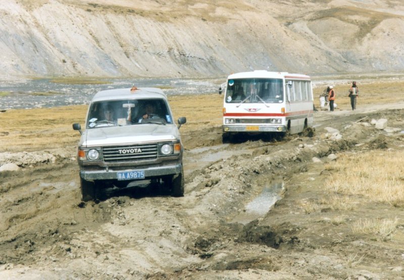
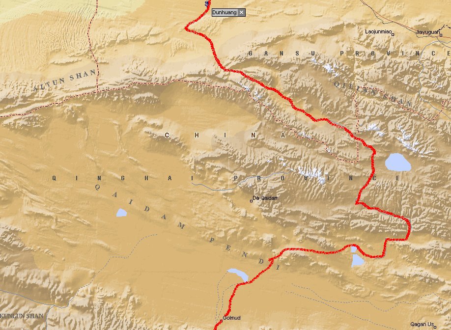
Day 17: Dunhuang - Golmud
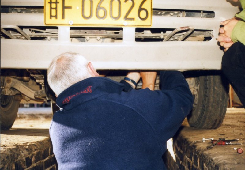
 In the morning we drove to Golmud. After 5 minutes the bus stopped. Problems? Looked like it,
because the driver turned back to the city and drove to a garage. The gas cable was broken.
After 20 minutes the bus was still not repaired, so Rien took the initiative to repair it
himself. And this worked. The bus did not break down during this 12 hour drive through the
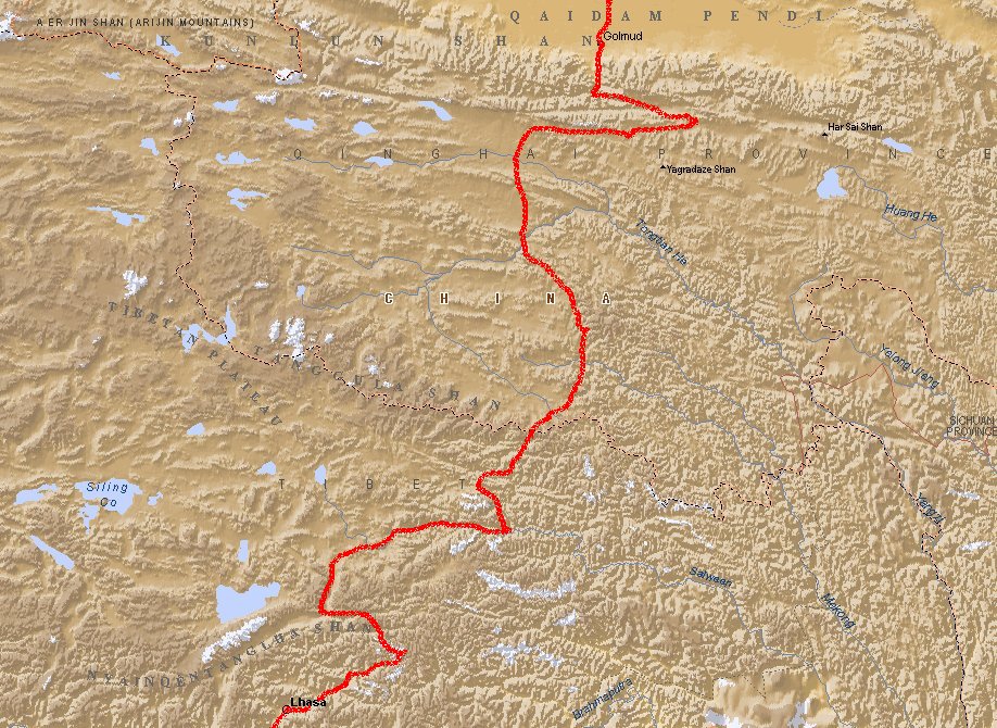
Qaidam-Pendi desert. Golmud (3200 m.) is a garrison-town that lies on the Tibetan plateau.
In the morning we drove to Golmud. After 5 minutes the bus stopped. Problems? Looked like it,
because the driver turned back to the city and drove to a garage. The gas cable was broken.
After 20 minutes the bus was still not repaired, so Rien took the initiative to repair it
himself. And this worked. The bus did not break down during this 12 hour drive through the
Qaidam-Pendi desert. Golmud (3200 m.) is a garrison-town that lies on the Tibetan plateau.
This was the first test for me at high altitude after the problems I had in the first week
of the journey. So far so good. In Golmud I bought an oxygen-cushion to make sure that in
case of problems I had something to relieve the problems.
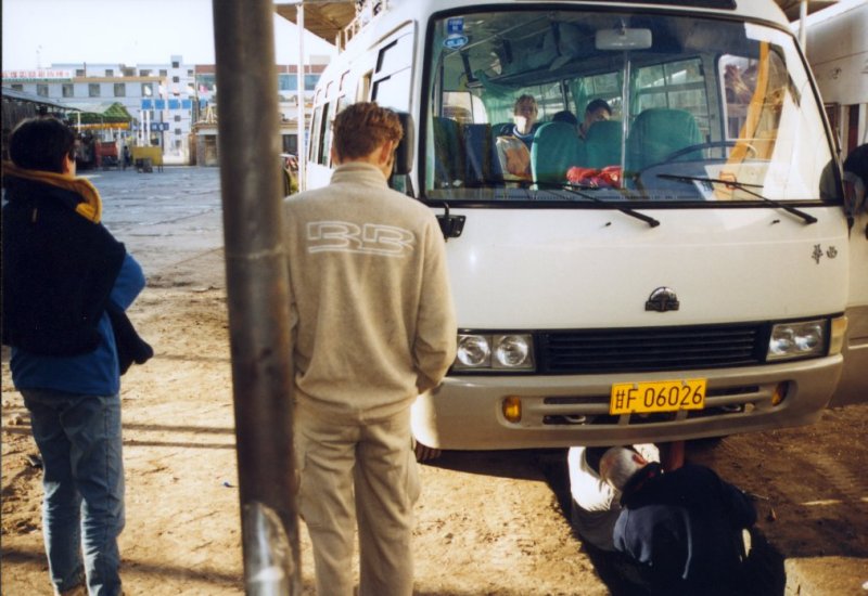
Day 18/19: Golmud - Lhasa
Around midnight we took a sleeper-bus to Lhasa. This is a very difficult part of the journey.
It took us 38 hours. The driver was a young chinese guy. After one hour he stopped the bus
and said "I am going to sleep". We didn't like this and cursed and yelled at him. Finally
he started driving again. Since he was driving like a drunk there was always someone from
our group keeping an eye on him during the night. They say this is the highest road on earth.
From Golmud you drive over
the Kunlun-pass (4837 m.) and the Tuotuo mountain. You go to Wenquan, the highest city in
the world (5100 m.) and go over the Tanggu-pass (5180 m.). This pass is almost always covered
with snow. The first night in the bus was extremely cold. I could not sleep despite the
fact that I had three blankets.
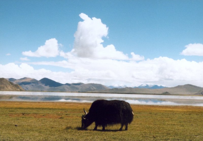
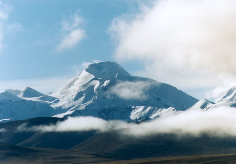
 After Naqu you drive on the desolate plaines where you see a few nomads with horses and yaks.
The road is sometimes gone and they made bypasses next to the road. In the west you'll see
the white peak of the Nyainqen Tanghla (7088 m.). At six o'clock in the morning we arrived
at Lhasa (3683 m.).
After Naqu you drive on the desolate plaines where you see a few nomads with horses and yaks.
The road is sometimes gone and they made bypasses next to the road. In the west you'll see
the white peak of the Nyainqen Tanghla (7088 m.). At six o'clock in the morning we arrived
at Lhasa (3683 m.).
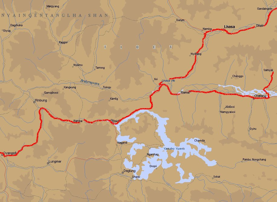
Day 20/21/22: Lhasa
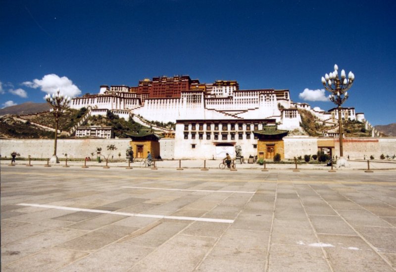
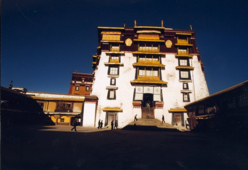
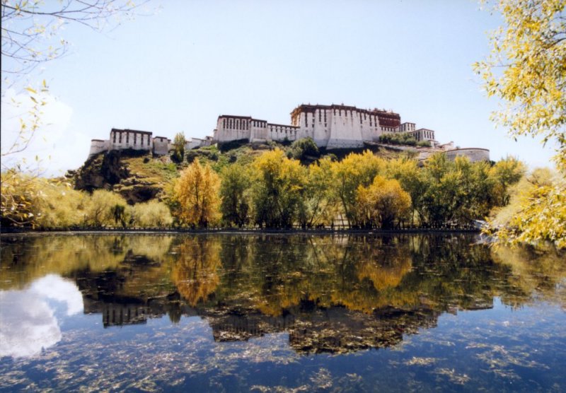
Lhasa, the capital of Tibet, is a fascinating city. The eyecatcher is the Potala, the palace
of the Dalai Lama. He fled to India in 1959. The palace is 117 m. high and has 13 stories.
The complex consists of three parts: a white and a red palace and a small yellow part in
between. The white part contains living quarters, offices, the seminary and the printing-office.
The red palace has a religious funtion. In the yellow part you'll find the huge embroyded
banners covered with holy symbols. There are about 1000 rooms in the palace and 10,000
monuments and 20,000 statues. When you are standing on the goldplated roof you have a magnificient
view over the Yarlong valley.
Behind the palace lies the Zang Gyab Lhukang Park (the Dragon King Pool park). It was
man-made when they were building the a new part of the Potala Palace in the 17th
century (fifth Dalai Lama period).
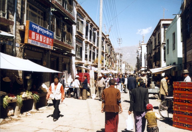
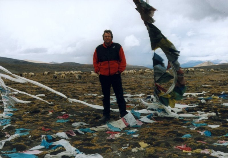
 Around the Jokhang temple (the place to go to as a pilgrim) is the Barkhor-bazar. Everything
you need to buy as a pilgrim is present: prayer-flags, temple clocks, yak butter.
Around the Jokhang temple (the place to go to as a pilgrim) is the Barkhor-bazar. Everything
you need to buy as a pilgrim is present: prayer-flags, temple clocks, yak butter.
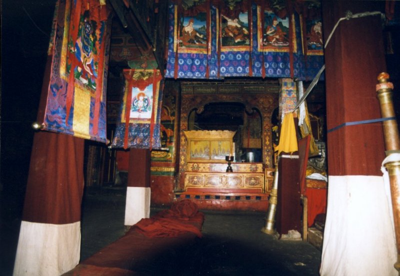
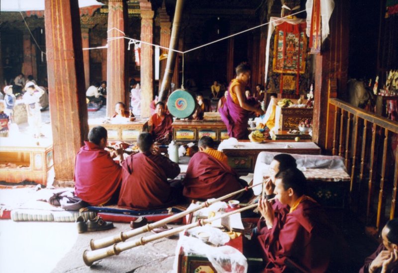
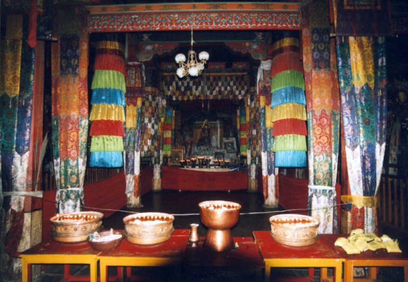
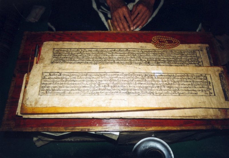 In the Mona-Seru monastery Sander and I got a personal tour. They showed us many books of
prayer and other holy documents. In the temple we withnessed a service. At this occaision
we drank yak-butter tea.
In the Mona-Seru monastery Sander and I got a personal tour. They showed us many books of
prayer and other holy documents. In the temple we withnessed a service. At this occaision
we drank yak-butter tea.
Day 23: Lhasa - Samye

Driving along the Yarlung Zangbo river in eastern direction you come across a place were
you have to take a boat to go to Samye. After an hour you are at the other side where a
truck is waiting to take you to the monastery that lies 9 km away. It is a very bumpy ride.
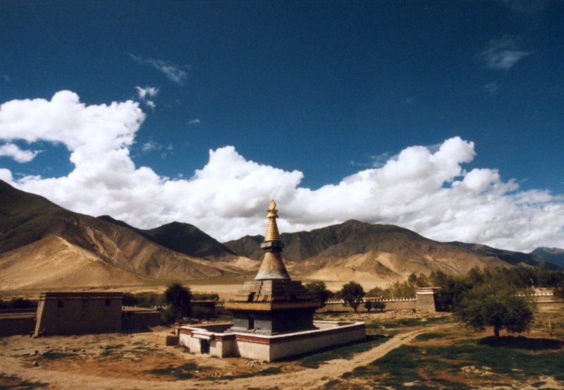
The monastery is the oldest of Tibet. It is founded in 779 by the Second Religious King,
Tritsong Detsen. Today it is still an important place in Tibet, because Tibetans believe
that on day 42 after someone has died the spirit goes to Samye. Here the decision is made
in what form he shall reincarnate.
We spend the night here in the Monastery Guesthouse. It is rather primitive, but a great
experience. The only place where you find water is on the inner court.
Day 24: Samye - Gyangze


In the morning we took the truck and the boat back to were we came from yesterday. We drive
back in eastern direction along the river. The road to Gyangze is long and takes us back
to the high mountains. The first pass is the Khamba-pass (4695 m.) where you have a
fantastic view of the Yamdrok Yumtso lake. This is one of the holy lakes in Tibet. The second
pass is the Kora-pass (Kampala pass) (5045 m.).
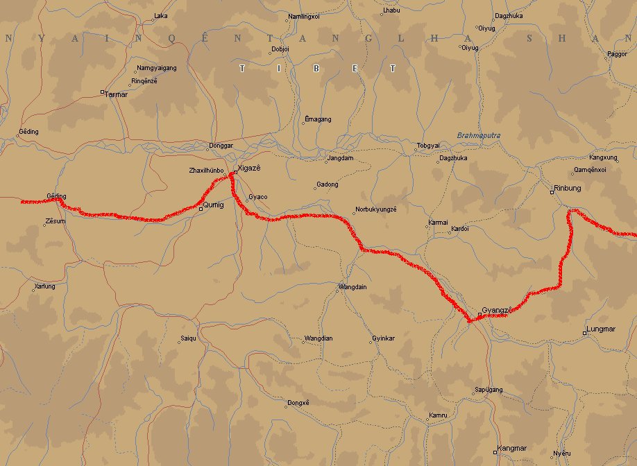
Day 25/26: Gyangze - Xigaze
 Gyangze (3800 m.) is the 4th city in Tibet. Here you can still find a Tibetan atmosphere in
most parts of the city, although the Chinese influence is getting bigger.
Gyangze (3800 m.) is the 4th city in Tibet. Here you can still find a Tibetan atmosphere in
most parts of the city, although the Chinese influence is getting bigger.
You can visit the Pango Chorten, a nice example of 15th century Newari-art. It is the only
Newari Chorten that still exists in Nepal. Around the chorten lies the Palkhor Choide monastry
where you can see lovely murals. Climbing to the fortress on top of the hill is also worth
doing. It gives you a great view of the city. I realized at this point that I didn't have
any problems with walking at high altitude.
The road to Xigaze takes you through one of the most richest agricultural area's of Tibet.
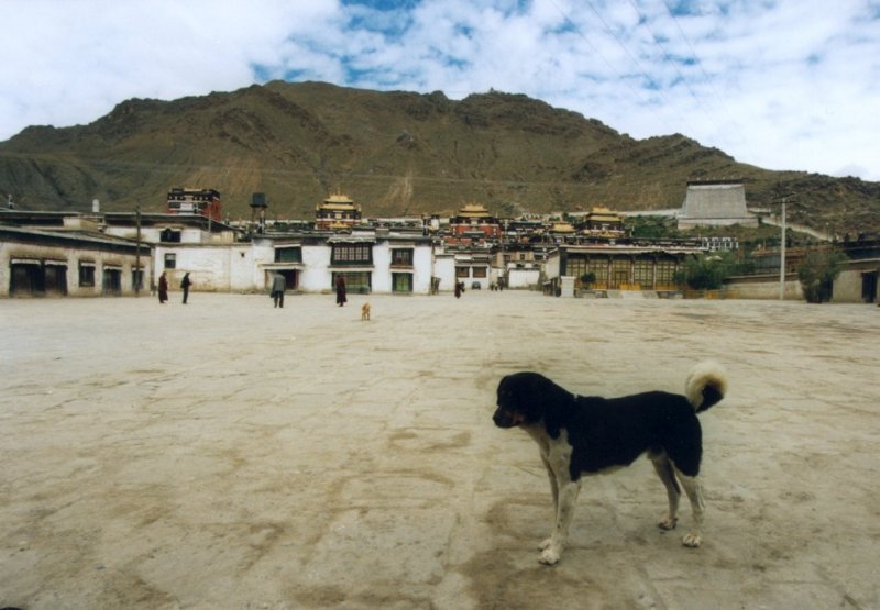
The Tashilumpo monastery is one of the four "Yellowhat Sect" monasteries of Tibetan Buddhist
and was founded in 1447 by Gedun Drupa (the first Dalai Lama).
At night the streets are ruled by hundreds of dogs. They kept me awake for many hours. Tibetans
believe that monks sometimes reincarnate as dogs to protect their villages and monasteries.
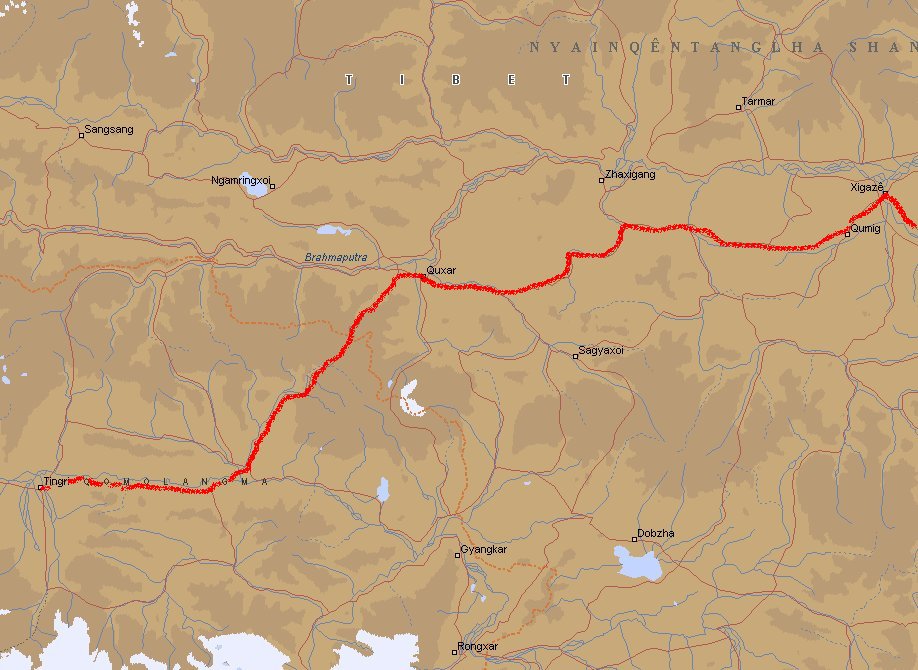
Day 27: Xigaze - Lao Tingri

Lao Tingri lies at 4300 m. It used to be a center for merchants who traded rice, grain and
iron from Nepal for wool and salt from Tibet. Nowadays it is a poor village and food is scarce.
Near Tingri you can see Mount Everest (8848 m.) clearly. This is the best area to see the
mountain from the Friendship Highway (the road from Lhasa to Kathmandu). It is clear why the
locals call the mountain Qomolangma (the big one).
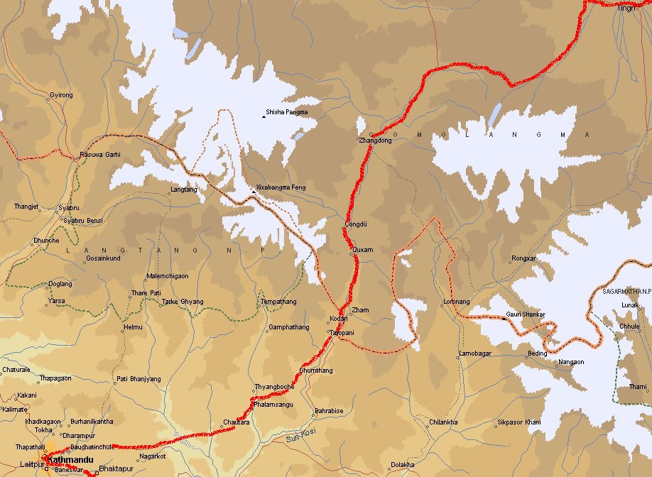
Day 28: Lao Tingri - Zhangmu/Kodari - Kathmandu
 In the morning we left Tingri. It was 7 o'clock and still dark. So we missed a nice view
on Everest. We are now on our way to Zhangmu near the border. Driving through the Himalaya
we go from the Tibetan highlands (4000 m.) downwards to Nepal (2300 m.). The vegatation
changes dramatically from dry grasland to subtropical rainforest type valleys. Between
Tibet and Nepal lies a piece of nomans-land (9 km.). You can walk if you like it, but it is
better to take a truck. There is only one truck available, but two men are offering the
service. The first one says "for 200 per person I bring you to the border, the truck will
arrive in 1 hour". Then the second one comes along and says "for 250 per person, I will
bring you, the truck will be here in 10 minutes". Don't let them fool you, they work together.
Take the lowest price.
In the morning we left Tingri. It was 7 o'clock and still dark. So we missed a nice view
on Everest. We are now on our way to Zhangmu near the border. Driving through the Himalaya
we go from the Tibetan highlands (4000 m.) downwards to Nepal (2300 m.). The vegatation
changes dramatically from dry grasland to subtropical rainforest type valleys. Between
Tibet and Nepal lies a piece of nomans-land (9 km.). You can walk if you like it, but it is
better to take a truck. There is only one truck available, but two men are offering the
service. The first one says "for 200 per person I bring you to the border, the truck will
arrive in 1 hour". Then the second one comes along and says "for 250 per person, I will
bring you, the truck will be here in 10 minutes". Don't let them fool you, they work together.
Take the lowest price.
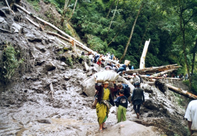 I forgot to take some passport photo's with me, so we were a bit worried how to get a
visa for Nepal. No problem, just make a nice picture on the application form. They are
only interested in the 30 dollars that you pay. The bus that would bring us to Kathmandu
could not reach the border due to a landslide. A Landcruiser took us (group of 13 persons with
backpacks) to the landslide. Here we had to walk with our luggage over mud and broken trees
to our bus. Under normal road conditions it is about 4 hours driving to Kathmandu. It took
us a few hours more.
I forgot to take some passport photo's with me, so we were a bit worried how to get a
visa for Nepal. No problem, just make a nice picture on the application form. They are
only interested in the 30 dollars that you pay. The bus that would bring us to Kathmandu
could not reach the border due to a landslide. A Landcruiser took us (group of 13 persons with
backpacks) to the landslide. Here we had to walk with our luggage over mud and broken trees
to our bus. Under normal road conditions it is about 4 hours driving to Kathmandu. It took
us a few hours more.
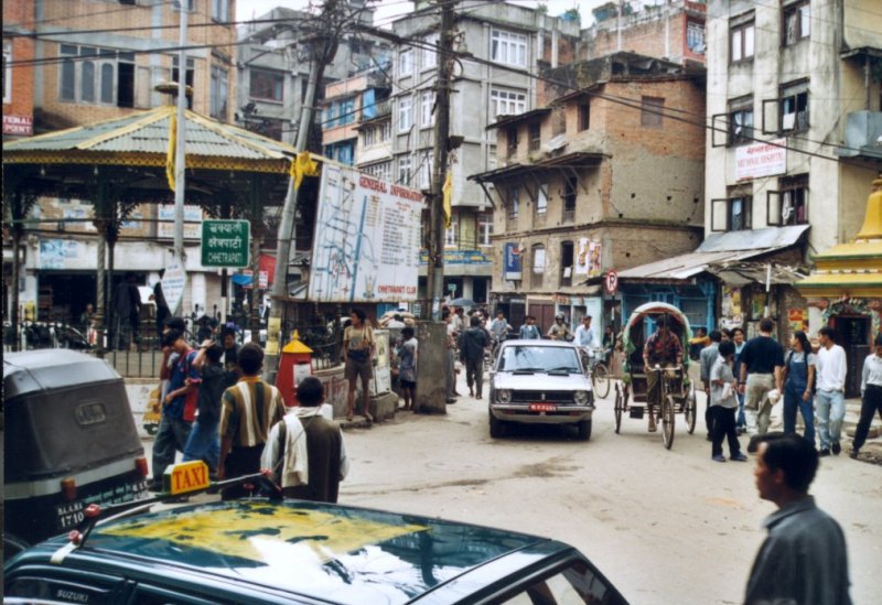
Day 29/30: Kathmandu
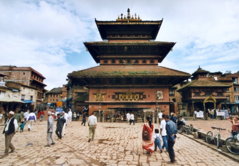
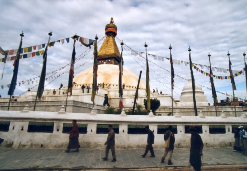 Kathmandu is the capital of Nepal. Together with the two other kingdom-cities Patan and
Bhaktapur it lies in a valley. It is a very hectic place with lots of tourists. Riksja's,
beggars and money-changers all ask for your attention. People who are selling hashish also.
There are many places you can visit. Boedist and Hindu temples, palaces, pagodes. Near
Durbar Square you find most of them. At Kumari Bahal you can try to catch a glimpse of the
Kumari, a girl who lives in this temple as a goddess. She is not allowed to do anything and
her live as a goddess is over when she has her first period. Or if she cuts herself. Then
she will live as an outcast, because Nepali believe that she will die in the first months
of her marriage.
Kathmandu is the capital of Nepal. Together with the two other kingdom-cities Patan and
Bhaktapur it lies in a valley. It is a very hectic place with lots of tourists. Riksja's,
beggars and money-changers all ask for your attention. People who are selling hashish also.
There are many places you can visit. Boedist and Hindu temples, palaces, pagodes. Near
Durbar Square you find most of them. At Kumari Bahal you can try to catch a glimpse of the
Kumari, a girl who lives in this temple as a goddess. She is not allowed to do anything and
her live as a goddess is over when she has her first period. Or if she cuts herself. Then
she will live as an outcast, because Nepali believe that she will die in the first months
of her marriage.
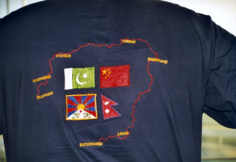
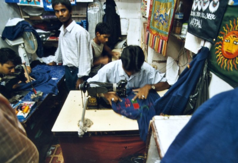 In Thamel you can find a lot of little shops where they put embroideries on T-Shirts.
We had made our own design and they made 13 pieces in 1 day.
In Thamel you can find a lot of little shops where they put embroideries on T-Shirts.
We had made our own design and they made 13 pieces in 1 day.
Day 31: Leave Kathmandu
 After paying 1000 rupies at the airport you can leave the country. Watch out for the X-ray
machine at the airport. It is notorious for destroying your films. So take them out of your
luggage and put them in you pockets.
After paying 1000 rupies at the airport you can leave the country. Watch out for the X-ray
machine at the airport. It is notorious for destroying your films. So take them out of your
luggage and put them in you pockets.
Day 32: Arrival in Amsterdam
Via Abu Dhabi and Paris we arrive at Schiphol. The holiday is over. We give each other a
big hug or kiss and say goodbye. We all have good memories about this long and heavy
journey.
This document was last updated on 28/10/99