| Holiday 2000 in Scandinavia |
Sweden's climate is comparatively moderate, considering that the country is so far
north. The principal moderating influences are the North Atlantic Drift (an extension
of the Gulf Stream) and the prevailing westerly winds, which blow in from the
relatively warm North Atlantic Ocean. In winter, these influences are offset by
cold air masses that sweep in from the east. The climate of northern Sweden is
considerably colder than that of the south, primarily because it has higher elevations
and because the mountains cut off the moderating marine influence. The average
temperature in February, the coldest month, is below 0 °C (32 °F)
throughout Sweden, with temperatures ranging from -3 °C (27 °F) in
Stockholm to -1 °C (30 °F) in Gothenburg and -12 °C (10 °F) in
Haparanda in the northern part of the country. In July, the warmest month, the
average temperatures are 18 °C (64 °F) in Stockholm, 17 °C
(63 °F) in Gothenburg, and 15 °C (59 °F) in Haparanda. The proportion
of daylight hours increases in the summer and decreases in the winter as the
latitude becomes more northerly. In the region of Sweden north of the Arctic
Circle, daylight is continuous for about two months in the summer, and continual
darkness occurs for about two months in the winter.
The country consists mostly of tableland, with average heights of about 120 to 180
metres (395 to 590 feet) above sea level. The terrain is generally level; hilly areas
are more prominent in the north, and mountains are found in the extreme northwest.
Haltiatunturi (1.324 metres/4.344 feet) in the northwest, near the Norwegian border,
is the highest point.
Due to the moderating influence of the surrounding bodies of water, the climate of
Finland is considerably less severe than might be expected. The average July
temperature along the southern coast is 16 °C (61 °F). In February the
average is about -9°C (16 °F). Light snow covers the ground for four or
five months a year in the south and about seven months in the north.
The warm waters of the North Atlantic Drift, an extension of the Gulf Stream, flow
along the Atlantic coast of Norway and have a pronounced moderating effect on the
climate. A maritime climate prevails over most of the coastal islands and lowlands.
Winters are mild and summers are normally cool. At Bergen, the mean January temperature
is 2 °C (36 °F) and the mean July temperature is 14 °C (57 °F).
Moisture is plentiful all year round. The average annual precipitation on the coast is
about 1,778 millimetres (70 inches). In the interior a more continental climate
prevails: winters are colder and summers are warmer. At Oslo, the January mean
temperature is -3 °C (27 °F) and the July mean is 17 °C (63 °F).
In the highlands of Nord Norge, the climate is subarctic. The coastal areas of this
region, however, have a moderate maritime climate, and most ports, even in the far
north, are free of ice in winter.
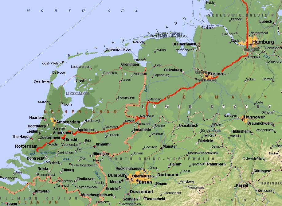
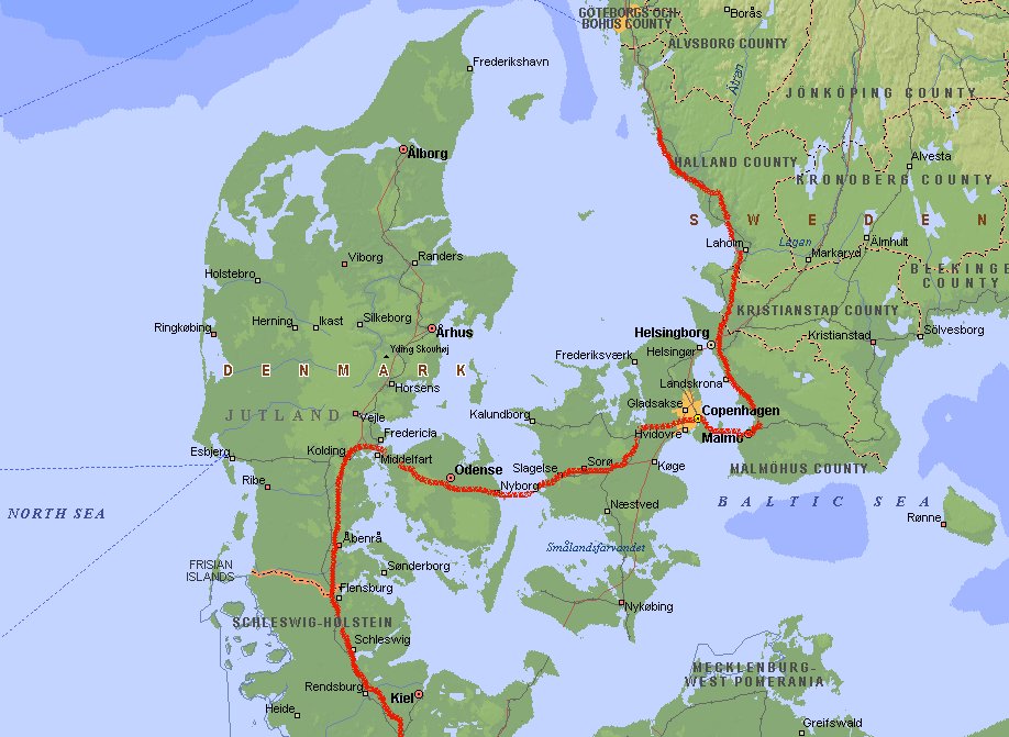
Day 1: Ridderkerk -
Korsør (869 km)
The first part of the journey is for me not really exciting. Drivin from the south-west
part of the Netherlands to the border at Denekamp, through Germany (passing Lingen,
Meppen, Bremen, Hamburg and Flensburg) and then entering Denmark. Since I've been
here before I am not going to stop and make pretty pictures. Besides, the landscape
is a bit dull.
I was once before in Denmark in 1977. We stayed on the mainland (Jutland) then, but
now we visit the large islands and drive towards Kopenhagen. After crossing the island Fyn
we end the day near Korsør, on the island of Sjælland. The islands are
nowadays connected by bridges. The first one is toll-free but for the second one
you still have to pay a lot (Dkr 340).
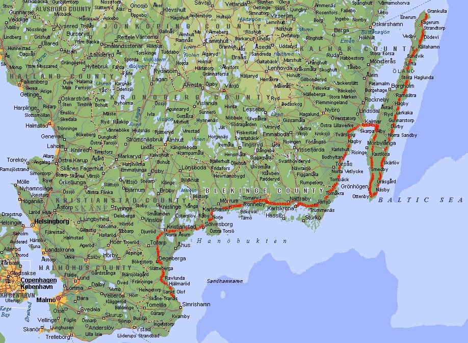
Day 2: Korsør - Simrishamn (1270 km)
The original plan was to take the ferry just south of Kopenhagen to Malmö. When
we arrive the signs are already taken away - no ferry anymore because of the new
bridge-tunnel connection. Bummer, I don't mind taken the bridge, but it is not open for
another two weeks. So we decide to drive north to Helsingør. Here we take the
ferry to Helsingborg (Dkr 500 for car with caravan and 2 persons) and then its south
again towards Malmö and then to Ystad and Simrishamn.
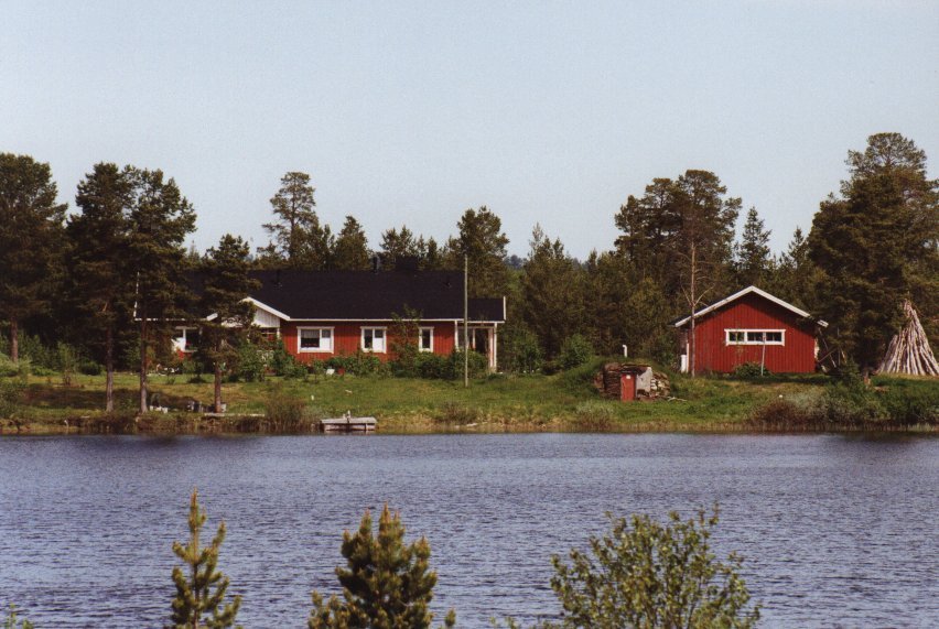
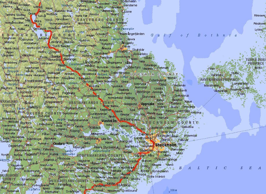
Day 3: Simrishamn - Nabbelund (1727 km)
 We follow the coast and drive through places like Kristianstad, Karlshamn and
Karlskrona. At Kalmar we drive over the 6 km long bridge to the Baltic island
Öland, a very popular place in summer for the Swedes. In July and August it is
crowded, but in June you can still roam around freely. There are more than 400 old
wooden windmills on the island. Most of them are in a pretty bad state and they don't
look like Dutch windmills, although I've seen it written in a travel guide.
We follow the coast and drive through places like Kristianstad, Karlshamn and
Karlskrona. At Kalmar we drive over the 6 km long bridge to the Baltic island
Öland, a very popular place in summer for the Swedes. In July and August it is
crowded, but in June you can still roam around freely. There are more than 400 old
wooden windmills on the island. Most of them are in a pretty bad state and they don't
look like Dutch windmills, although I've seen it written in a travel guide.
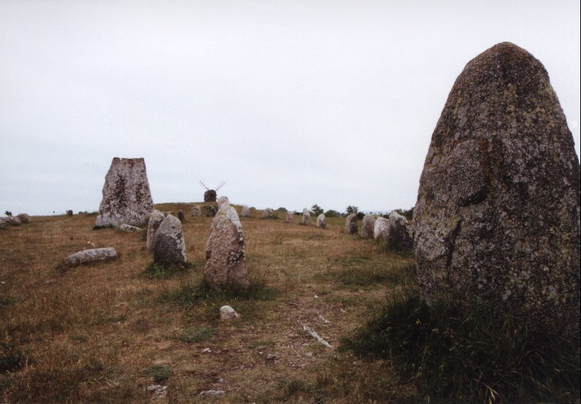
Öland's most intersting sites include numerous ruined castles and Bronze and
Iron Age burial cairns, runic stones and forts. At the south part of the island is
a big bird reserve.
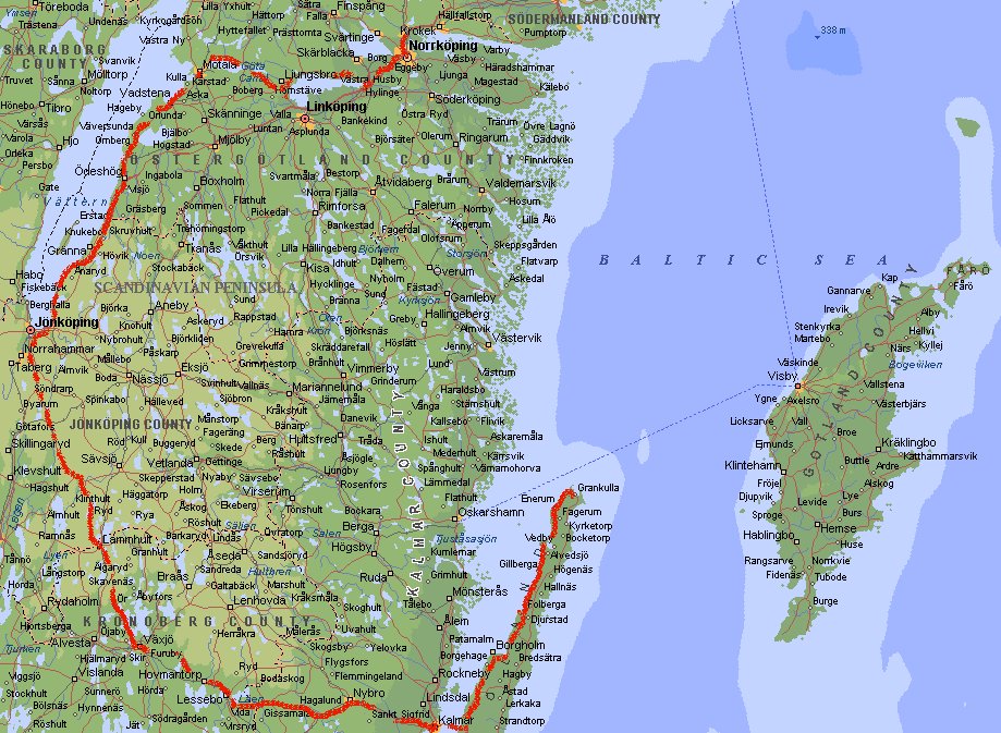
Day 4: Nabbelund - Norrköping (2304 km)
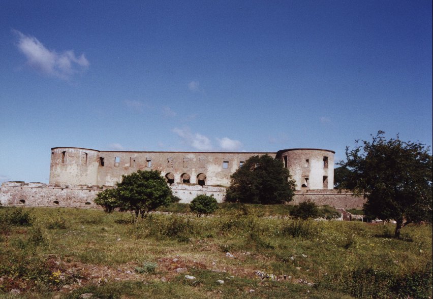 Borgholms Slotts ruin, lying at the west side of Öland. One of the many ruins
on the island. The castle gave the town Borgholm it's name, borg means castle.
It was already a ruin when the town was founded in 1816. The castle was build in
the twelfth century and fortified four hundred years later by King Johan III. The
present shape, with a tower at each corner, was given in the seventeenth century.
It was regularly attacked and fell eventually into disrepair. In 1806 there was
even a fire.
Borgholms Slotts ruin, lying at the west side of Öland. One of the many ruins
on the island. The castle gave the town Borgholm it's name, borg means castle.
It was already a ruin when the town was founded in 1816. The castle was build in
the twelfth century and fortified four hundred years later by King Johan III. The
present shape, with a tower at each corner, was given in the seventeenth century.
It was regularly attacked and fell eventually into disrepair. In 1806 there was
even a fire.
We go back to the mainland and drive west towards Växjö and
Jönköping. There we follow the east bank of Lake Vättern all the way to
Motala. Our journey continues through Linköping and by the end of the day we
stop just north of Norrköping.
Day 5: Norrköping - Dalfors (2818 km)
 Via Nyköping we go to Stockholm. Since we are a bit ahead of our scheme we decide
not to go directly towards the coast (the road to Uppsala and Gävle), but to go
west to Enköping, Avesta and Borlange. Via Rättvik and Mora we go to Orsa.
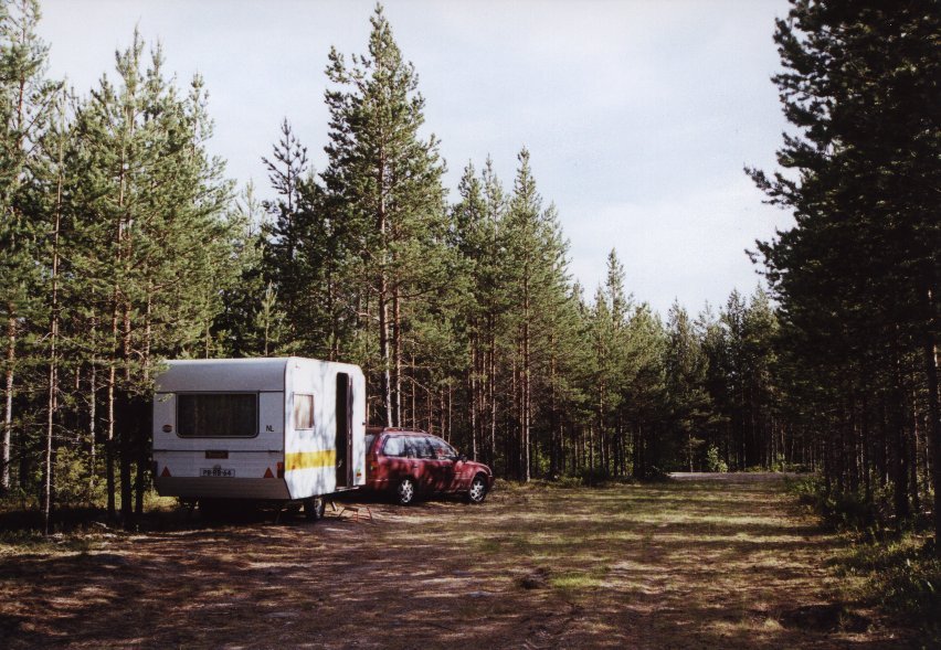
At this point the landscape becomes more mountainous. Like most of the days we just camp
somewhere in the wild.
Via Nyköping we go to Stockholm. Since we are a bit ahead of our scheme we decide
not to go directly towards the coast (the road to Uppsala and Gävle), but to go
west to Enköping, Avesta and Borlange. Via Rättvik and Mora we go to Orsa.
At this point the landscape becomes more mountainous. Like most of the days we just camp
somewhere in the wild.
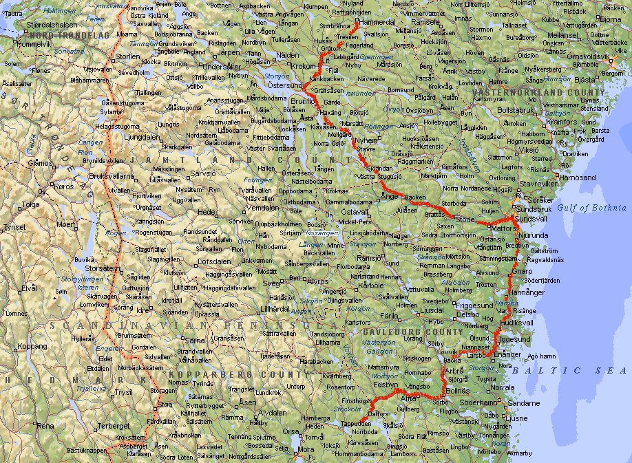
Day 6: Dalfors - Hammerdal (3305 km)
 The road continues through Bollnäs and we see the Gulf of Bothnia again near
Hudiksvall. At Sundsvall we decide again to go back westwards (no we are not unable
to make up our minds) towards Östersund. There the road goes north to Hammerdal.
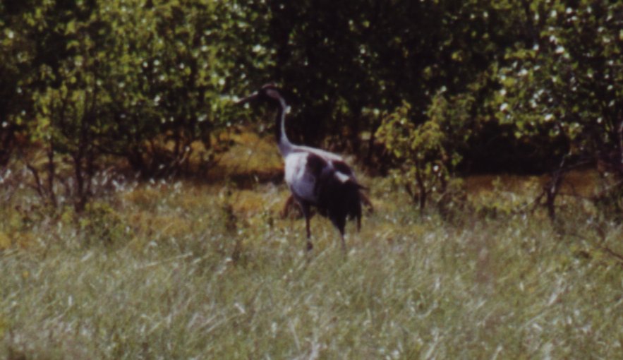
North of Hammerdal we spot two crane birds. As soon as we stop they walk away behind
the bushes. We still manage to take a picture of one of them.
The road continues through Bollnäs and we see the Gulf of Bothnia again near
Hudiksvall. At Sundsvall we decide again to go back westwards (no we are not unable
to make up our minds) towards Östersund. There the road goes north to Hammerdal.
North of Hammerdal we spot two crane birds. As soon as we stop they walk away behind
the bushes. We still manage to take a picture of one of them.
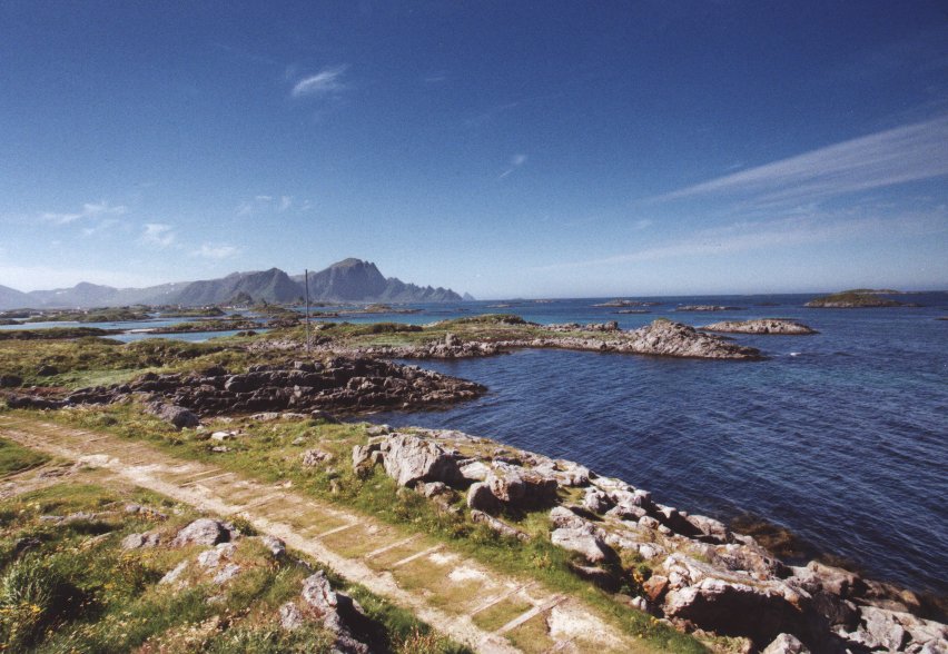
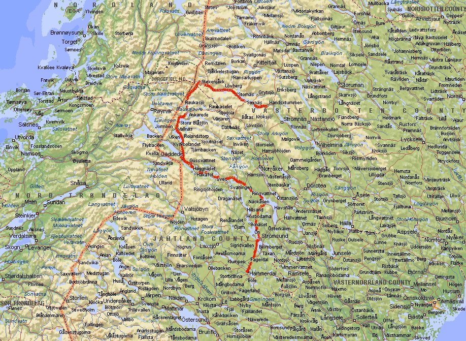
Day 7: Hammerdal - Bångnäs (3677 km)
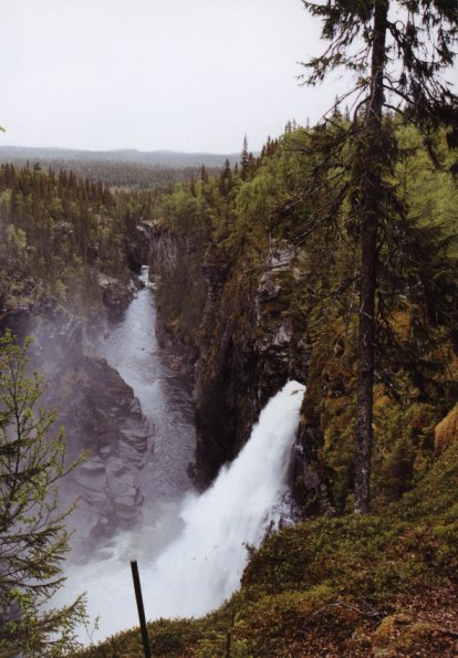
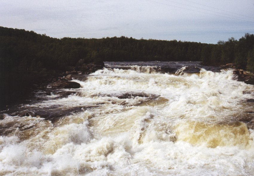
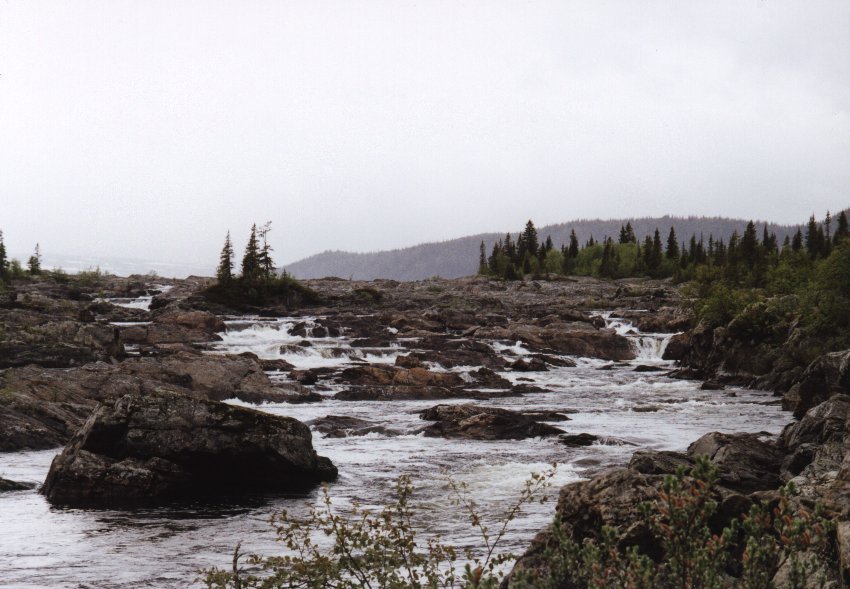 From Hammerdal we go to Strömsund where we enter the Wilderness Way
(Vildmarksvägen), as road 342 is known. This is a narrow and winding road
that goes to the mountains between Sweden and Norway. It's also the area in
Sweden with the densest population of bears. Near Bågede you can
follow a very rocky road to Hällsingsåfallet, an impressive waterfall
that falls into an 800 m long canyon. At Gäddede you go north to climb above
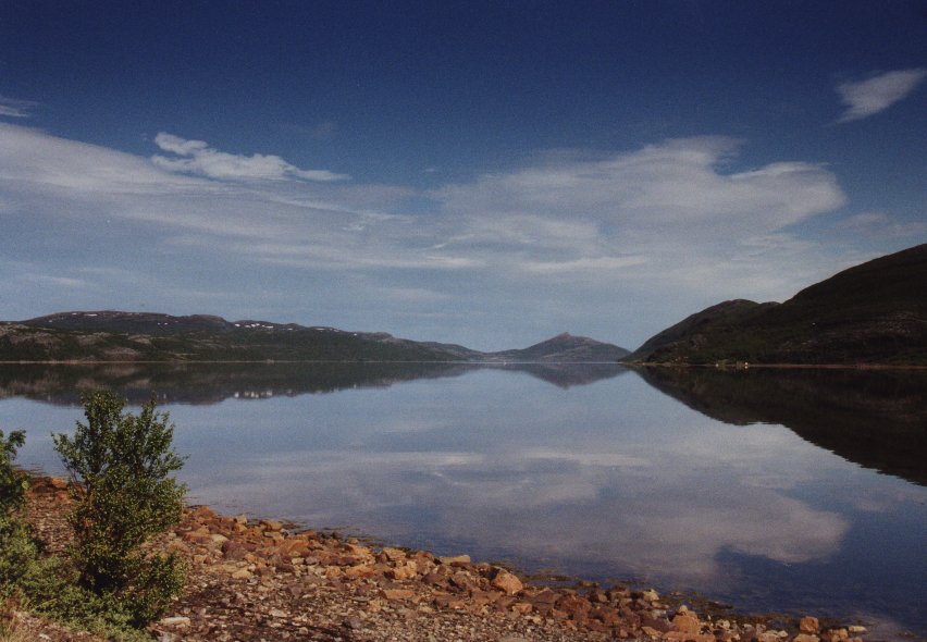
the tree line to cross the Stekenjokk Plateau into the province of Lapland. The picture
on the right are the Litsjöforsen.
From Hammerdal we go to Strömsund where we enter the Wilderness Way
(Vildmarksvägen), as road 342 is known. This is a narrow and winding road
that goes to the mountains between Sweden and Norway. It's also the area in
Sweden with the densest population of bears. Near Bågede you can
follow a very rocky road to Hällsingsåfallet, an impressive waterfall
that falls into an 800 m long canyon. At Gäddede you go north to climb above
the tree line to cross the Stekenjokk Plateau into the province of Lapland. The picture
on the right are the Litsjöforsen.
Day 8: Bångnäs - Älvsbyn
(4092 km)
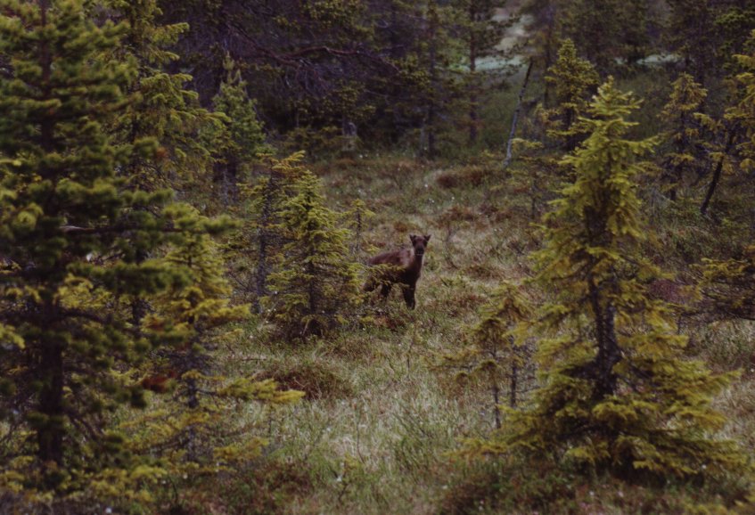
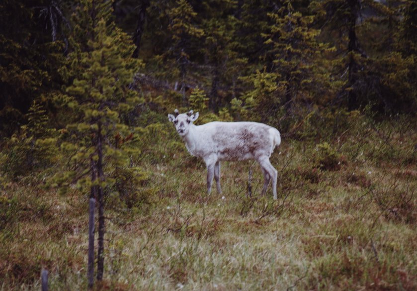 At Vilhelmina we go north again towards Sorsele and Arvidsjaur. A few reindeer are
curious to see what we are doing when we pass by and stop to take a picture.
At Vilhelmina we go north again towards Sorsele and Arvidsjaur. A few reindeer are
curious to see what we are doing when we pass by and stop to take a picture.
Lapland is the heartland of the Sami, Scandinavia's oldest culture. Most people will
call them Lapps, but it is rather a bad word, just like the word Eskimo (Inuit).
They probably descended from the original, prehistoric inhabitants of much of Scandinavia
and northern Russia. Today there are about 58.000 Sami. What I find interesting is the
fact that their language is based on a harmonious natural existence: there is no word
for certain alien concepts (like 'war'), but there are 90 different terms to express
variations in snow conditions. Near Älvsbyn we spend the night.
Day 9: Älvsbyn - Emolahti (4562 km)
 Following the coast from Luleå to Haparanda we enter Finland at Tornjo. We stay
just below the Arctic Circle, but the amount of sunlight per day is quite
a lot. It does not get really dark at all. In principle, thanks to to the light
refraction in the atmosphere, the Midnight Sun can be seen south of the Arctic
Circle. Arvidsjaur marks the southernmost point in Sweden where you can see it
on June 20/21. We didn't experience this although we were there exactly on 20 June.
Taking the road to Kemi and Oulu we go south and stop at Emolahti near Pyhäjärvi.
Following the coast from Luleå to Haparanda we enter Finland at Tornjo. We stay
just below the Arctic Circle, but the amount of sunlight per day is quite
a lot. It does not get really dark at all. In principle, thanks to to the light
refraction in the atmosphere, the Midnight Sun can be seen south of the Arctic
Circle. Arvidsjaur marks the southernmost point in Sweden where you can see it
on June 20/21. We didn't experience this although we were there exactly on 20 June.
Taking the road to Kemi and Oulu we go south and stop at Emolahti near Pyhäjärvi.
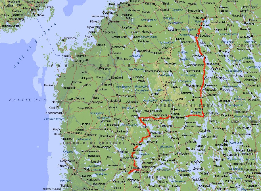
Day 10: Emolahti - Vammala (5027 km)
We pass towns like Viitasaari and Äänekoski and at Jyväskylä
we go west to Keuruu and Virrat. There the road goes south again to Ruovesi, Kuru
and Tampere. Ruovesi was once voted the most beautiful village in Finland. There
is not much to see or do, but the surrounding wilderness is scenic. Again going
south-west we pass Nokia and stop just before Vammala.
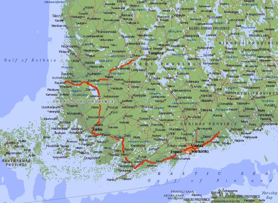
Day 11: Vammala - Porvoo (5469 km)
 Via Huittinen and Eura we go to Rauma where we visit the old wooden part Vanha Rauma.
There are about 600 houses and 150 shops and each building has a name. Although it
is listed on the UNESCO World Heritage List I was not very impressed. A bit
disappointed we drive back to Eura and go south to Turku. Along the coast towards
Espoo and Helsinki we end the day at Porvoo, the second oldest town in Finland
after Turku. Officially it has been a town since 1346, but even before that Porvoo
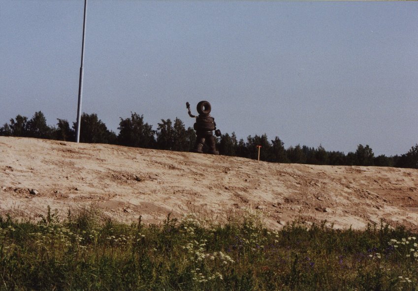
was an important trading center. On our way we see a very artistic piece of
art next to the road (see picture), a man made from tires. We spend the night at a
parking lot near the highway. During the evening you can see a lot of trading taking
place between Finns and Russians. Liquor and cigarettes seem to be favourite.
Via Huittinen and Eura we go to Rauma where we visit the old wooden part Vanha Rauma.
There are about 600 houses and 150 shops and each building has a name. Although it
is listed on the UNESCO World Heritage List I was not very impressed. A bit
disappointed we drive back to Eura and go south to Turku. Along the coast towards
Espoo and Helsinki we end the day at Porvoo, the second oldest town in Finland
after Turku. Officially it has been a town since 1346, but even before that Porvoo
was an important trading center. On our way we see a very artistic piece of
art next to the road (see picture), a man made from tires. We spend the night at a
parking lot near the highway. During the evening you can see a lot of trading taking
place between Finns and Russians. Liquor and cigarettes seem to be favourite.
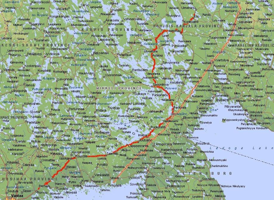
Day 12: Porvoo - Eno (5942 km)
Away from the coast we go to Kouvola, Lappeenranta and Imatra in the Lakeland.
In this region you'll find numerous lakes, islands norrow straits, canals and
beaches. Here we are very close to the Russian border. It is part of Karelia, a
region that actually continues into Russia. After World War II this was the only
part of Karelia that remained Finnish territory. At Jaakkolanryhma it is only a few
hundred meters. At Savonlinna we go north to Enonkoski. Near Hanhivirta suddenly in
the middle of nowhere the road stops at the lakeside. Fortunately there is a ferry
that takes you to the other side (for free). After Joensuu we head for Eno were we
stop for the night.
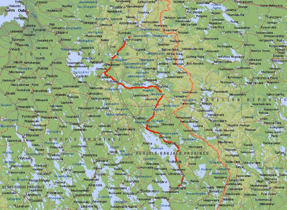
Day 13: Eno - Hyrynsalmi (6326 km)
 Following the scenic road to Lieksa and Nurmes we take the road to Kuhmo and Sotkamo.
Unfortunately we didn't see the Patvinsuo National Park between Lieksa and
Ilomantsi. You can see swans, cranes and lots of other birds here. Also bears and
can be seen. The whole area is a marshland, but it has a boardwalk network.
We take the road at the northside of the lake and head for Hyrynsalmi.
Following the scenic road to Lieksa and Nurmes we take the road to Kuhmo and Sotkamo.
Unfortunately we didn't see the Patvinsuo National Park between Lieksa and
Ilomantsi. You can see swans, cranes and lots of other birds here. Also bears and
can be seen. The whole area is a marshland, but it has a boardwalk network.
We take the road at the northside of the lake and head for Hyrynsalmi.
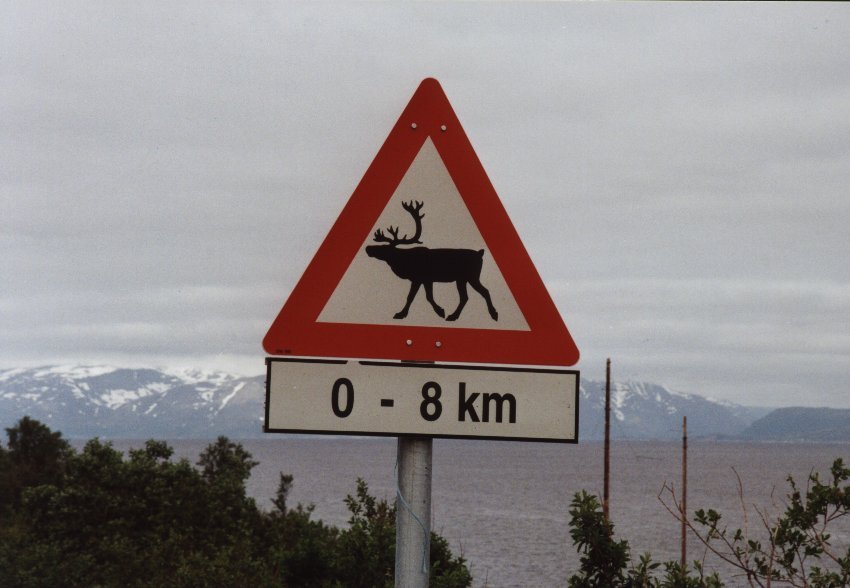
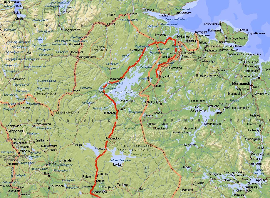
Day 14: Hyrynsalmi - Vuotso (6836 km)
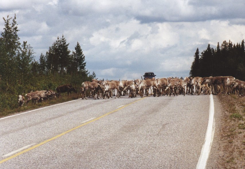 Here we encounter the first real big herd of reindeer. The leader of the group stands
in the middle of the road and then the rest will follow. Honking your horn doesn't help
with these animals. Just relax for 5 minutes and you can continue.
Here we encounter the first real big herd of reindeer. The leader of the group stands
in the middle of the road and then the rest will follow. Honking your horn doesn't help
with these animals. Just relax for 5 minutes and you can continue.
The road goes to Kuusamo and at Kemmijärvi we turn towards Sodankylä. Just
before Kemmijärvi we have passed the Polar Circle. They don't make a big
fuss out of it, unlike in Rovaniemi or Norway. There is only a small sign and we
practically missed it. South of Vuotso we stop. If you like trekking then this is a
very good place. North-east of here lies the Saariselkä Wilderness (including Urho
Kekkonen National Park), one of the most popular trekking areas in Finland. It extends
all the way to the Russian border.
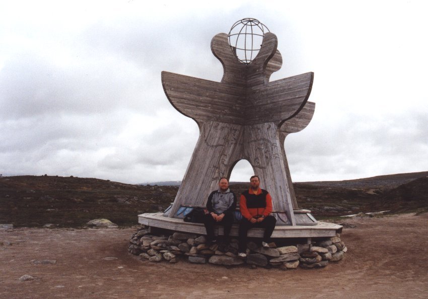
Day 15: Vuotso - Nyrud (7267km)
 We continue driving north and drive through Ivalo and Inari, the main Sami comunity
in this region. Gold panning seems to be popular here. Just before Kaamanen
we turn east to Sevettijärvi. At Näätämö we cross
the border and enter Norway. After a few kilometers you'll see the Skollefossen
(see picture), a nice waterfall. There we take the road towards Kirkeness.
Fuel prices are about Nkr 11.50 per liter in the northern part of Norway.
At Hesseng we go south all the way to Nyrud. We spend the night at the edge of
the Øvre Pasvik Nasjonal Park. The road to the parking lot inside the park is
9 km long and after about 1 km we decide that this poorly surfaced road is just a little
bit too much for the car and caravan. Potholes that are 20 cm deep are all over the
place. Turning means hooking off the caravan and turn them separately. Even this turns
out to be a challenge. It is difficult to find a place where we can turn the car.
Meanwhile the mosquitoes are having a great dinner while we turn the caravan.
We continue driving north and drive through Ivalo and Inari, the main Sami comunity
in this region. Gold panning seems to be popular here. Just before Kaamanen
we turn east to Sevettijärvi. At Näätämö we cross
the border and enter Norway. After a few kilometers you'll see the Skollefossen
(see picture), a nice waterfall. There we take the road towards Kirkeness.
Fuel prices are about Nkr 11.50 per liter in the northern part of Norway.
At Hesseng we go south all the way to Nyrud. We spend the night at the edge of
the Øvre Pasvik Nasjonal Park. The road to the parking lot inside the park is
9 km long and after about 1 km we decide that this poorly surfaced road is just a little
bit too much for the car and caravan. Potholes that are 20 cm deep are all over the
place. Turning means hooking off the caravan and turn them separately. Even this turns
out to be a challenge. It is difficult to find a place where we can turn the car.
Meanwhile the mosquitoes are having a great dinner while we turn the caravan.
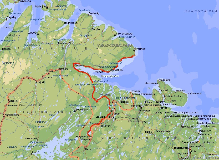
Day 16: Nyrud - Vardø (7612 km)
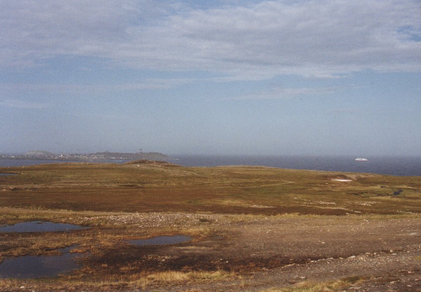 We take the same road back to Hesseng and follow the Varanger Fjord to Varangerbotn.
There we continue to follow the fjord, but this time from the other side towards
Vardø, Norway's easternmost town. It lies on an island in the Barentz Sea and
is connected to the mainland by the Ishavstunnelen (Arctic Ocean tunnel). It is a
poorly lighted small tunnel (2.9 km long) without proper ventilation. The mean
monthly temperature never exceeds 10 °C. This makes it the only mainland town of
Norway within the Arctic climate zone.
We take the same road back to Hesseng and follow the Varanger Fjord to Varangerbotn.
There we continue to follow the fjord, but this time from the other side towards
Vardø, Norway's easternmost town. It lies on an island in the Barentz Sea and
is connected to the mainland by the Ishavstunnelen (Arctic Ocean tunnel). It is a
poorly lighted small tunnel (2.9 km long) without proper ventilation. The mean
monthly temperature never exceeds 10 °C. This makes it the only mainland town of
Norway within the Arctic climate zone.
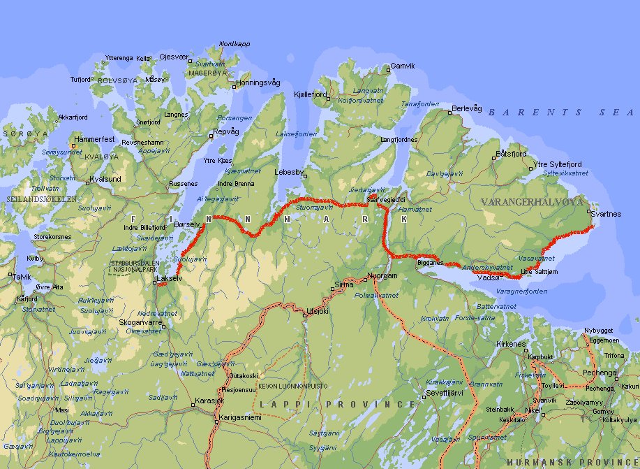
Day 17: Vardø - Lakselv (7975 km)
 We spend the night on the mainland just opposite to Vardø with a nice view
of the Barentsz Sea. It lies at the foot of a hill called Domen (156 m) where between
1621 and 1692 80 women were accused of witchcraft and burned to death.
We spend the night on the mainland just opposite to Vardø with a nice view
of the Barentsz Sea. It lies at the foot of a hill called Domen (156 m) where between
1621 and 1692 80 women were accused of witchcraft and burned to death.
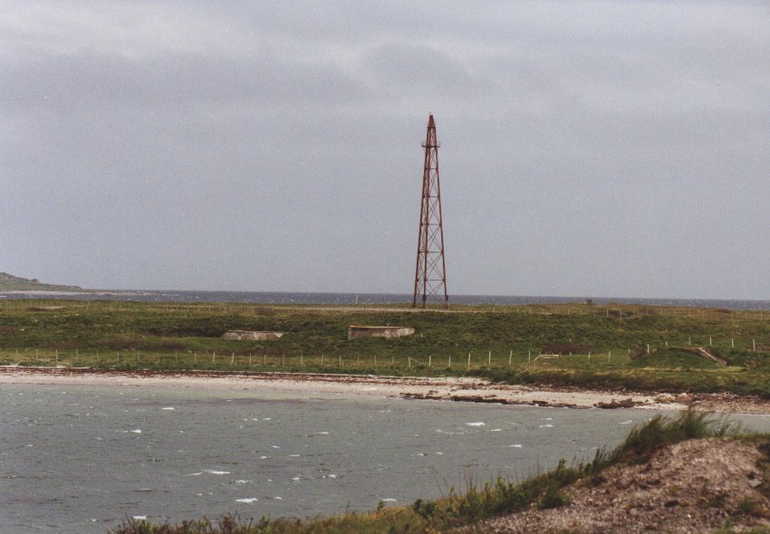
At Vadsø we stop to take a picture of an odd mast on Vadsø island.
The picture shows the mast that was build in the mid-1920s as a launch site for
Zeppelins. It was first used in 1926 by an expedition lead by Roald Amundsen, Umberto
Nobile and Lincoln Ellsworth, which flew via the North Pole to Alaska in the airship
Norge N-1.
At Tana Bru (named after the nice bridge) we go north to the coast. They say that this is
one of Europe's best salmon streams. The road is not used heavily by tourists, since
most of them come from the west coast and have Nordkapp as their destiny. But this makes
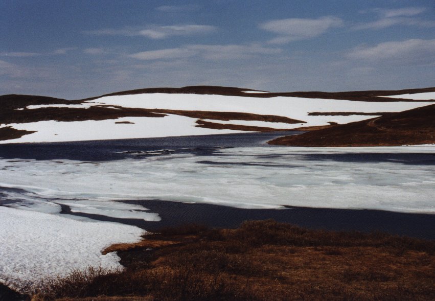
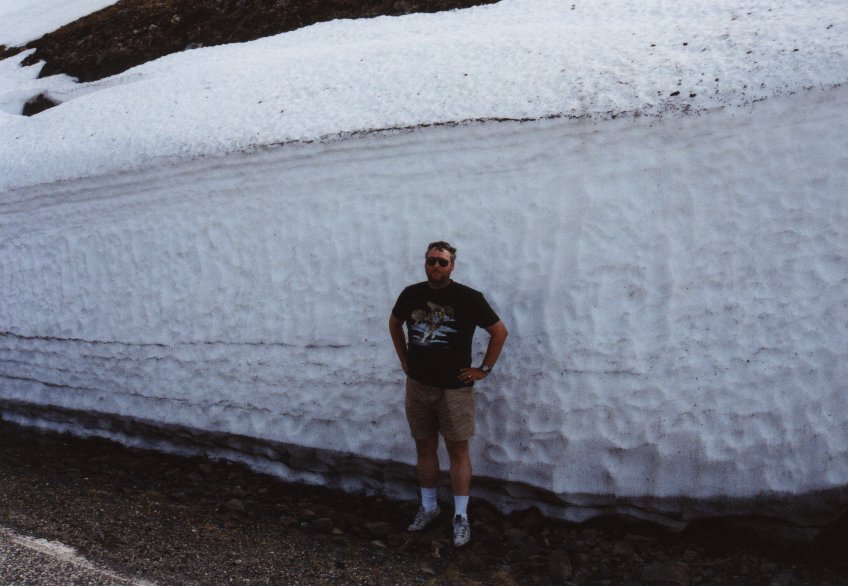
it even more attractive for us. Near Maskjok the scenery is very nice (see pictures).
The lake on the left was a perfect place for a good lunch. Immeadiately after that we
drove through some mountains where there was still snow on the northern slopes. At
Torhop even some lakes contained ice (3rd picture). The last picture shows me near a wall
of ice. Although it wasn't very cold the amount of snow was still very impressive. I
would love to see this in wintertime. After passing Børselv we stop at
Lakselv where the mosquitoes appear again. We didn't see them for many days due to the
relatively cold weather.
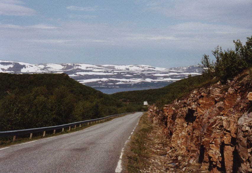
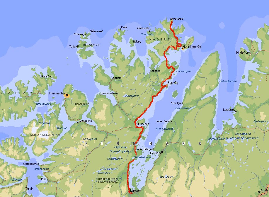
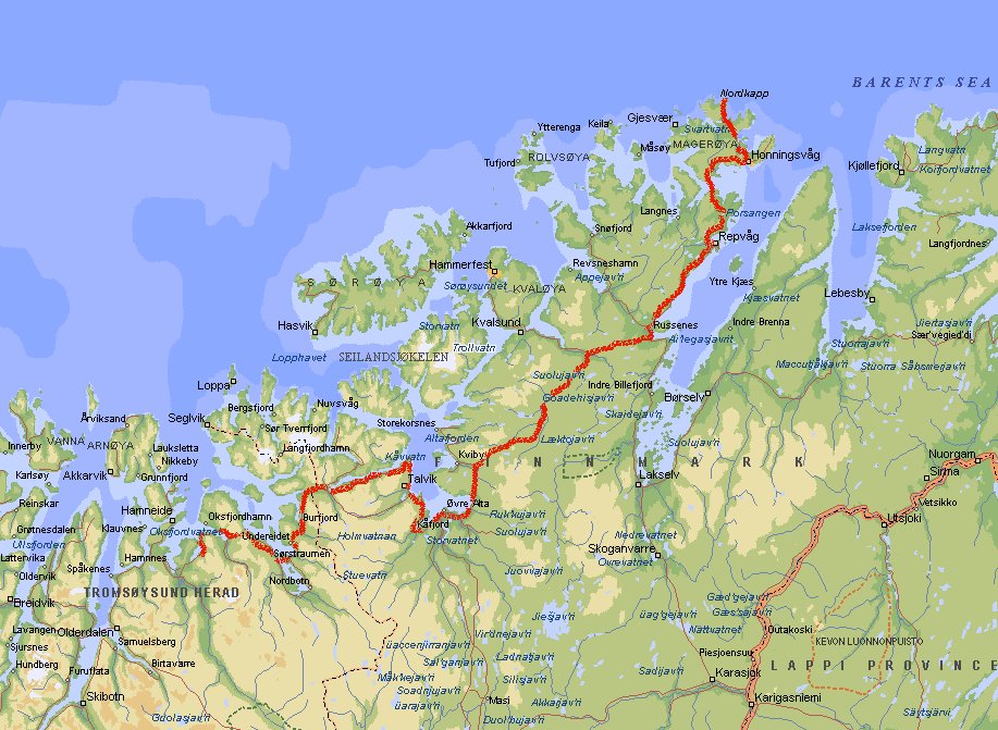
Day 18: Lakselv - Nordkapp (8160 km)

 We follow the Porsangen Fjord all the way to Nordkapp. It is a very scenic road, but
in some places rather narrow, so watch out for the many busses. They drive very
fast and will pass you before you know it (which can be a challenge when you're
driving with a caravan). The condition of the road is reasonable, but at some
places there is a lot of gravel where they tried to repair the road.
We follow the Porsangen Fjord all the way to Nordkapp. It is a very scenic road, but
in some places rather narrow, so watch out for the many busses. They drive very
fast and will pass you before you know it (which can be a challenge when you're
driving with a caravan). The condition of the road is reasonable, but at some
places there is a lot of gravel where they tried to repair the road.
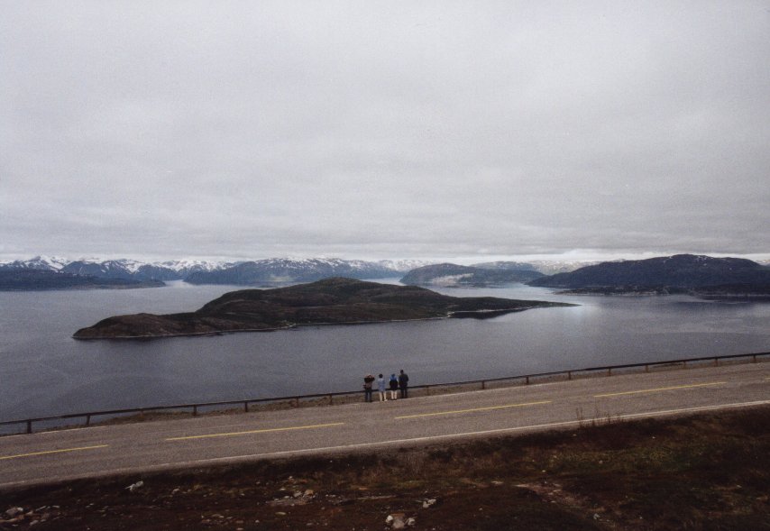
At 71° 10' 21" N lies Nordkapp, a high rugged plateau named by Richard Chancellor,
the English explorer who was searching in 1553 for a North-East passage. Entering
the complex is a very expensive experience, Nkr 175 per person. Although
they let you believe that this is the northernmost point of Europe this is not true.
Spitsbergen (or Svalbard is it is called by the Norwegians) lies about 1000 km north
of it. Well, its the northernmost point of mainland you might say. Also not true, first
of all it lies on an island (but connected to the mainland by a tunnel where you have
to pay Nkr 165 one way, so the next day when you return you'll pay again), and the second
point is that a few kilometers to the north-west the real northernmost point can be found.
It is called Knivskjelodden and lies at 71° 11' 08" N latitude. You can only
reach it by foot, it takes about 5 hours return. You can see it on the left picture.
Day 19: Nordkapp - Tretten (8590 km)
 You can spend the night on the parking lot at Nordkapp. Which was a very good idea,
because the thick fog covered the spot in just half an hour. We couldn't even see
the parking lot when we left the main building, which was only 30 m away. In the
morning the sky was clear again and we took off to drive back to Olderfjord and then to
Alta. The big attraction there are the prehistoric rock paintings at
Hjemmeluft. This is also a World Heritage Site. You can find between 2500 and 3000
Stone Age and Iron Age rock carvings. Alas the most prominent have been enhanced
(you could say repainted) with red-ochre paint, which is thought to be the original
color. At the end of the day we arrive at Tretten.
You can spend the night on the parking lot at Nordkapp. Which was a very good idea,
because the thick fog covered the spot in just half an hour. We couldn't even see
the parking lot when we left the main building, which was only 30 m away. In the
morning the sky was clear again and we took off to drive back to Olderfjord and then to
Alta. The big attraction there are the prehistoric rock paintings at
Hjemmeluft. This is also a World Heritage Site. You can find between 2500 and 3000
Stone Age and Iron Age rock carvings. Alas the most prominent have been enhanced
(you could say repainted) with red-ochre paint, which is thought to be the original
color. At the end of the day we arrive at Tretten.
Day 20: Tretten - Kanstad (9031 km)
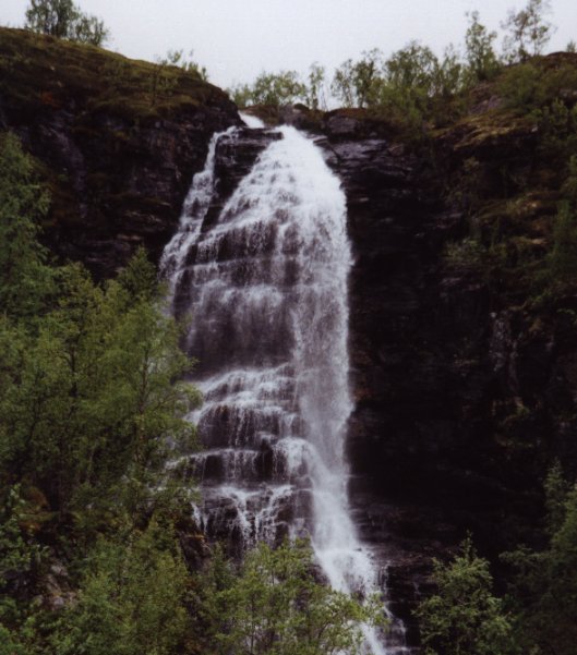 Early in the morning we pass this nice waterfall at Nordreisa. The road here is at some
places narrow and curved. The overhanging rocks are also something to be noticed,
especially when you drive a caravan, camper or bus. Still people drive here like crazy.
The road stays near the coast of the Lyngen Fjord for a long time and we pass places
like Djupvik and Skibotn. At Nordkjosbotn we skip the road to Tromsø and
go to the direction of Narvik.
Early in the morning we pass this nice waterfall at Nordreisa. The road here is at some
places narrow and curved. The overhanging rocks are also something to be noticed,
especially when you drive a caravan, camper or bus. Still people drive here like crazy.
The road stays near the coast of the Lyngen Fjord for a long time and we pass places
like Djupvik and Skibotn. At Nordkjosbotn we skip the road to Tromsø and
go to the direction of Narvik.
At the Polar Zoo near Setermoen you can watch the wildlife from the boreal taiga. The
animals stay in relatively natural enclosures (fenced woodland), so sometimes it
takes a while before you see the animals. If you come around noon it is easier to
spot them because then it is feeding time. Admission fee is Nkr 120 per person.
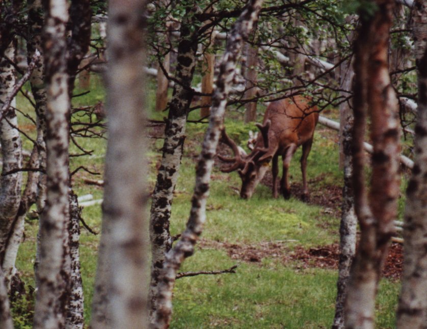
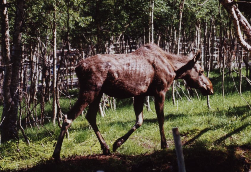
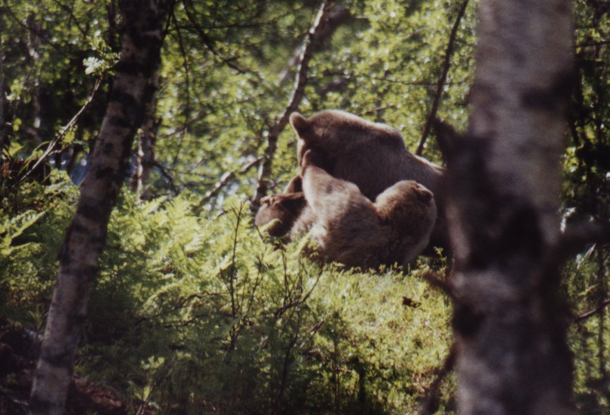
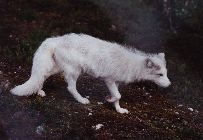
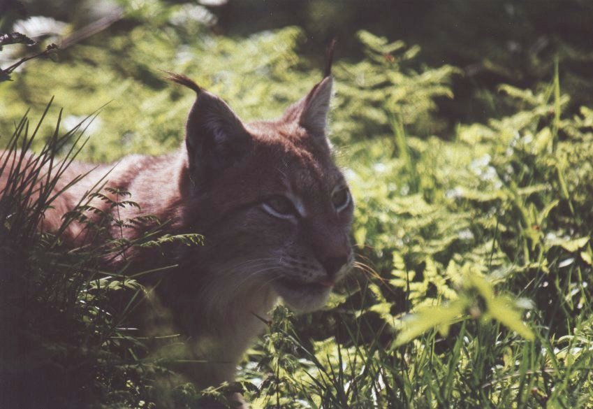

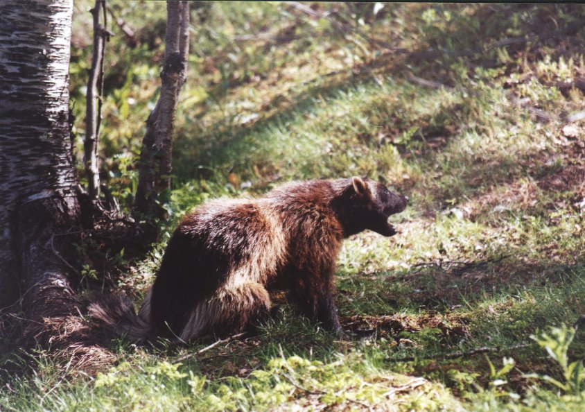


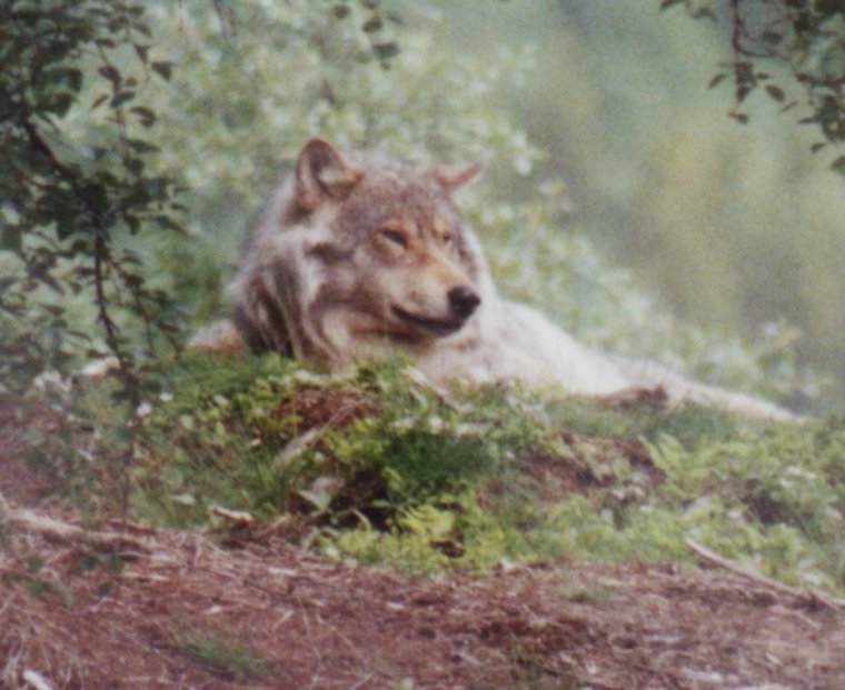 The pictures above show deer, moose, brown bears, arctic fox, lynx, wolverine and badger.
On the left you'll see a wolf. Also reindeer, roe deer and musk oxen are at the zoo.
The pictures above show deer, moose, brown bears, arctic fox, lynx, wolverine and badger.
On the left you'll see a wolf. Also reindeer, roe deer and musk oxen are at the zoo.
 At Gratangen we see the fantastic view from the left picture. The landscape becomes
greener and more trees appear. At Bjerkviv we enter the Ofoten district and head for
the Vesterålen. At Steinsland we take the bridge between the mainland and one of
the islands of the Vesterålen (Hinnøya). Most large islands here are
connected by bridges, so it is easier to explore this region than the Lofoten, a group
of islands just south of the Versterålen. The area here is much wilder and there
are even forested mountainous regions. Most of the northern coast of Norway is treeless.
At Gratangen we see the fantastic view from the left picture. The landscape becomes
greener and more trees appear. At Bjerkviv we enter the Ofoten district and head for
the Vesterålen. At Steinsland we take the bridge between the mainland and one of
the islands of the Vesterålen (Hinnøya). Most large islands here are
connected by bridges, so it is easier to explore this region than the Lofoten, a group
of islands just south of the Versterålen. The area here is much wilder and there
are even forested mountainous regions. Most of the northern coast of Norway is treeless.
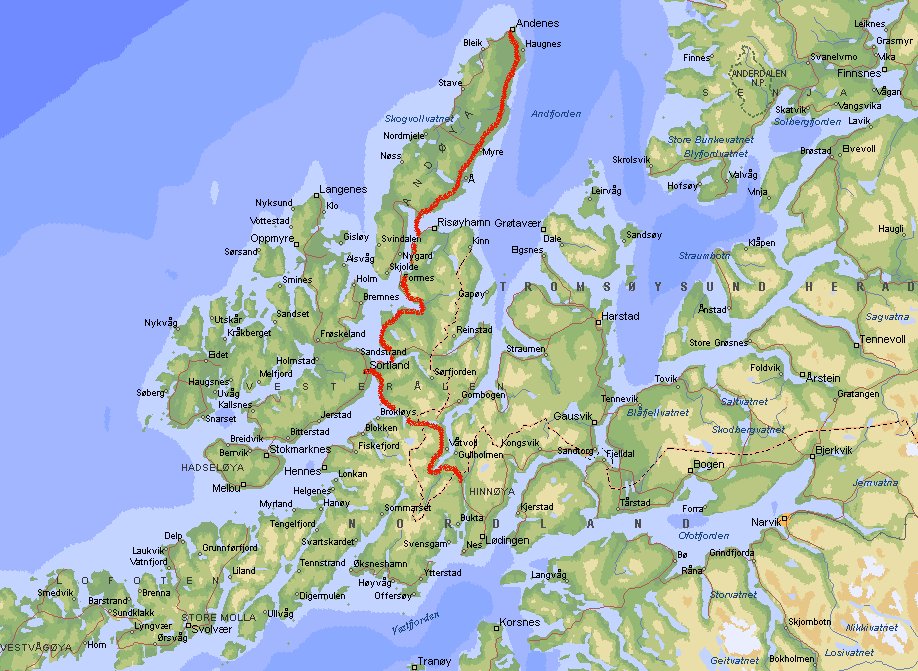
Day 21: Kanstad - Andenes - Kanstad (9337 km)
 After a short visit in Sortland (which lies on the island of Langøya) to
visit the gas station and the bank we go north to the island Andøya.
It is not as rugged as the rest of the Vesterålen, but thanks to the
1000 m deep waters off its north-western shore whale watching is an important tourist
attraction. These deep, dark and cold waters attract abundant stocks of squid which
in turn atract squid-loving sperm whales. The northern most town of Andøya
is Andeness (see pictures). You can start your whale watch safari near the lighthouse.
But be there early, because the safari started very early when we were there (8
o'clock a.m.), so we missed it.
After a short visit in Sortland (which lies on the island of Langøya) to
visit the gas station and the bank we go north to the island Andøya.
It is not as rugged as the rest of the Vesterålen, but thanks to the
1000 m deep waters off its north-western shore whale watching is an important tourist
attraction. These deep, dark and cold waters attract abundant stocks of squid which
in turn atract squid-loving sperm whales. The northern most town of Andøya
is Andeness (see pictures). You can start your whale watch safari near the lighthouse.
But be there early, because the safari started very early when we were there (8
o'clock a.m.), so we missed it.
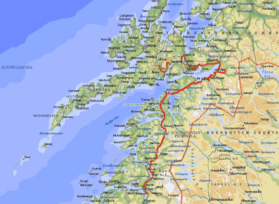
Day 22: Kanstad - Fauske (9747 km)
We continue on the Arctic Highway and pass Narvik. It was established a century ago
as an ice-free port for the rich Kiruna iron mines in Sweden. It is still a very
industrial looking city. We enter the area of the West Fjords and between Skarberget
and Bognes you'll have to take the ferry (Nkr 134). Between Kråkmotinden and Fauske
you'll see more tunnels than scenic views. The Kobbskardet Tunnel and the Kalvik
Tunnel are made from many separate tunnels, but fortunately the toll is not very
high (Nkr 90).
Fauske is mostly known for marble quarrying. Famous buildings that have used this
marble include the Oslo Rådhus and the UN building in New York. Fauske is also
known as the speedtrap capitol of Norway. Within a radius of 100 km (espicially
south of Rognan) the region derives a healthy income from creative radar traps. Even
5 km over the posted limit is deadly. On the spot you'll pay a fine of 1000 kroner
or more.
Day 23: Fauske - Smalåsen (10147 km)
 Between Fauske and Mo i Rana you cross the Arctic Circle. Driving along the Arctic
Highway you'll see the Polarsirkelsenteret where you can buy lots of souvenirs
as a rememberance that you've crossed the imaginary line at 66° 30' N, the
territory where in summer you can experience the Midsummernights Sun and in wintertime
total darkness without seeing the Sun for many days.
Between Fauske and Mo i Rana you cross the Arctic Circle. Driving along the Arctic
Highway you'll see the Polarsirkelsenteret where you can buy lots of souvenirs
as a rememberance that you've crossed the imaginary line at 66° 30' N, the
territory where in summer you can experience the Midsummernights Sun and in wintertime
total darkness without seeing the Sun for many days.
 South of Mosjøen you can find the roaring Laksforsen waterfall (17 m), where,
if you're in the right season, can see leaping salmon. We only saw a few busses with
leaping old German tourist after I kept on driving while they were standing in
the middle of the road. At Grane we saw this typical Scandinavian church. For a few
weeks I had been looking for one that was the right size, in good condition and
in such a place that you could take a very good picture without surrounding buildings.
We passed it, said "hey, that's exactly what we're looking for", and turned the car.
South of Mosjøen you can find the roaring Laksforsen waterfall (17 m), where,
if you're in the right season, can see leaping salmon. We only saw a few busses with
leaping old German tourist after I kept on driving while they were standing in
the middle of the road. At Grane we saw this typical Scandinavian church. For a few
weeks I had been looking for one that was the right size, in good condition and
in such a place that you could take a very good picture without surrounding buildings.
We passed it, said "hey, that's exactly what we're looking for", and turned the car.
Day 24: Smalåsen -
Dombas (10619 km)
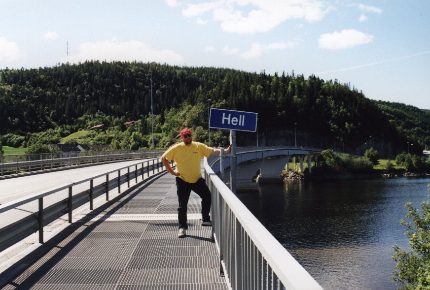
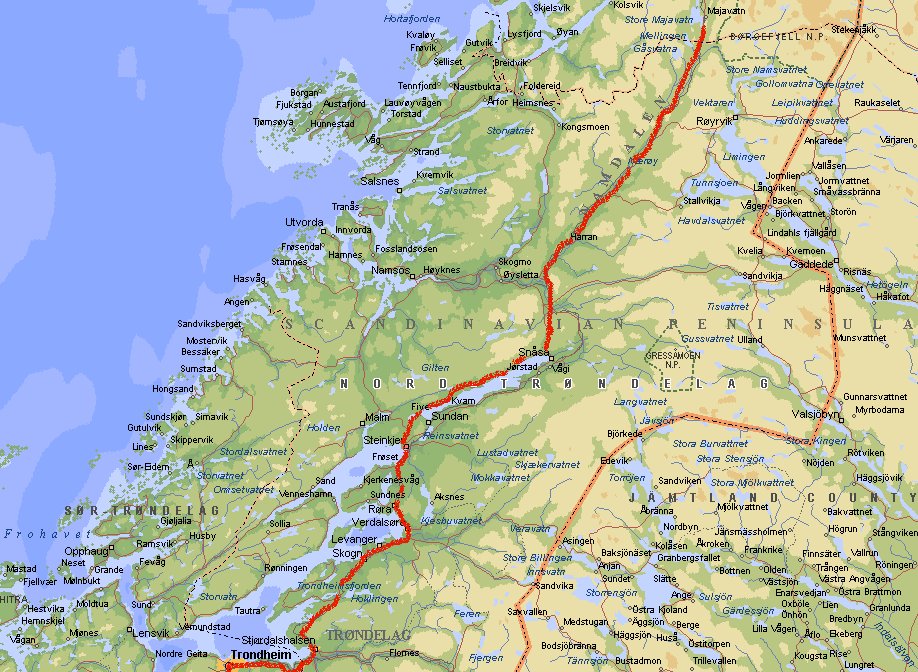
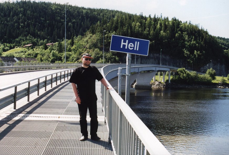 We keep following the road trough the Namdalen and then pass places like
Snåsa, Steinkjer and Trondheim (toll road). Just before Trondheim we visit
a place with a rather unusual name (see pictures).
We can honestly claim that we've been in Hell and it wasn't all that bad. I guess we're
not the first ones who make a picture here. For the rest there is nothing much to
say about Hell. Apparently it means something like 'prosperity'. South of Trondheim we
take the road to Oppdal and by the end of the day we arrive at Dombas.
We keep following the road trough the Namdalen and then pass places like
Snåsa, Steinkjer and Trondheim (toll road). Just before Trondheim we visit
a place with a rather unusual name (see pictures).
We can honestly claim that we've been in Hell and it wasn't all that bad. I guess we're
not the first ones who make a picture here. For the rest there is nothing much to
say about Hell. Apparently it means something like 'prosperity'. South of Trondheim we
take the road to Oppdal and by the end of the day we arrive at Dombas.
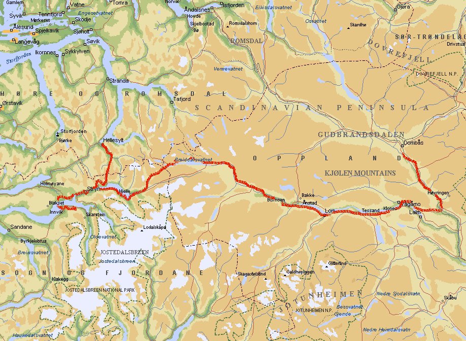
Day 25: Dombas - Breim (11040 km)
 The original plan was to go west towards Møre og Romsdal and drive along the
Trollstigveien towards the Geiranger Fjord, but I skipped this because they don't recommend
this with a caravan. So we drive to Otta and go west there. Passing places like Lom
and Stryn. After that we take road 60 to Hellesylt, which lies at the other end of
Geiranger Fjord. This road is also narrow and at some points badly surfaced, but
experienced drivers can do it when they are driving with a caravan. Unfortunately
we don't have a spectacular view of the fjord at Hellesylt, so be drive back and head
for Eid. There we go south to Lote where we take the ferry to Anda (Nkr 99). At Breim we
stop after a long day. I feel tired due to the constant concentration needed on these
narrow and winding roads.
The original plan was to go west towards Møre og Romsdal and drive along the
Trollstigveien towards the Geiranger Fjord, but I skipped this because they don't recommend
this with a caravan. So we drive to Otta and go west there. Passing places like Lom
and Stryn. After that we take road 60 to Hellesylt, which lies at the other end of
Geiranger Fjord. This road is also narrow and at some points badly surfaced, but
experienced drivers can do it when they are driving with a caravan. Unfortunately
we don't have a spectacular view of the fjord at Hellesylt, so be drive back and head
for Eid. There we go south to Lote where we take the ferry to Anda (Nkr 99). At Breim we
stop after a long day. I feel tired due to the constant concentration needed on these
narrow and winding roads.
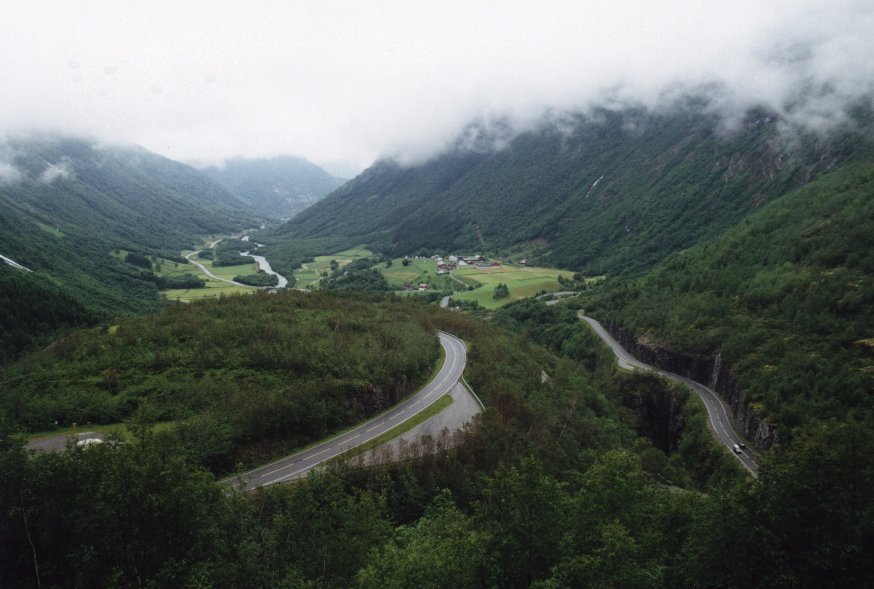
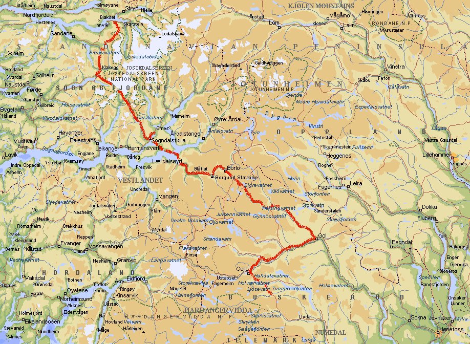
Day 26: Breim - Dagali (11374 km)
 Just after Klakegg we take the road to Sogndal. The tunnel to reach this area has a
toll fee of Nkr 135.
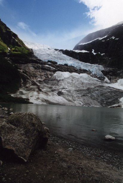
The Jostedalsbreen icecap (the largest mainland glacial area of Norway) lies in the
Sogn og Fjordana county. The picture shows the Bøyabreen, one of the
fastest advancing glaciers in Norway. You can see some glacial calving into the meltwater
lagoon beneath the glacier tongue.
At Sogndal we try to take the road to Nigard to see the Nigardsbreen glacier, but we
find the road just a bit to narrow and badly surfaced for my car. So we go back to
the main road and continue. After a short while we have to take yet another ferry
between Mannheller and Fodnes (Nkr 148) and visit Borgund.
Just after Klakegg we take the road to Sogndal. The tunnel to reach this area has a
toll fee of Nkr 135.
The Jostedalsbreen icecap (the largest mainland glacial area of Norway) lies in the
Sogn og Fjordana county. The picture shows the Bøyabreen, one of the
fastest advancing glaciers in Norway. You can see some glacial calving into the meltwater
lagoon beneath the glacier tongue.
At Sogndal we try to take the road to Nigard to see the Nigardsbreen glacier, but we
find the road just a bit to narrow and badly surfaced for my car. So we go back to
the main road and continue. After a short while we have to take yet another ferry
between Mannheller and Fodnes (Nkr 148) and visit Borgund.
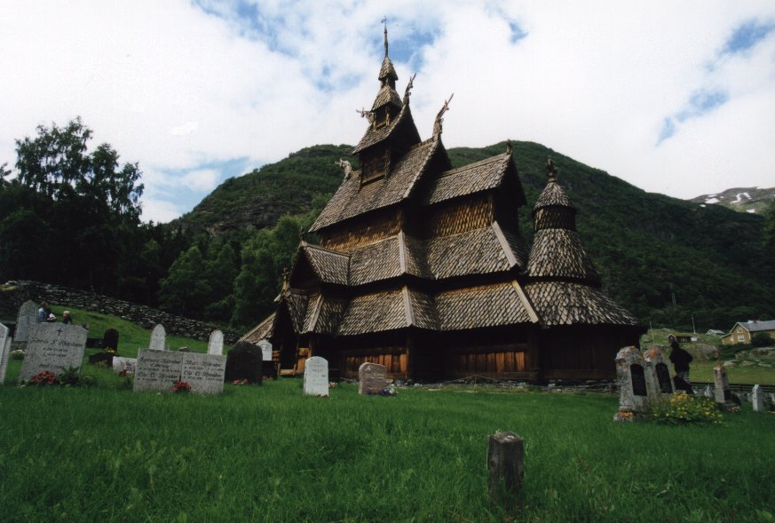 The Stavkirke at Borgund was build in the 12th century. It is the best preserved wooden
church in Norway. In total you can find 31 of these churches that were build in the
period when Norway was converted to Christianity. From there on we take the scenic
road to Gol and turn towards Geilo. South of Geilo we stop at Dagali. You'll find
many Stavkirke in this area.
The Stavkirke at Borgund was build in the 12th century. It is the best preserved wooden
church in Norway. In total you can find 31 of these churches that were build in the
period when Norway was converted to Christianity. From there on we take the scenic
road to Gol and turn towards Geilo. South of Geilo we stop at Dagali. You'll find
many Stavkirke in this area.
Day 27: Dagali - Hössvasdammen (11374 km)
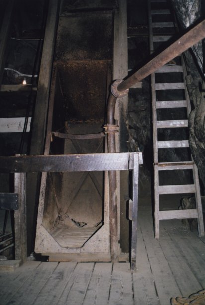
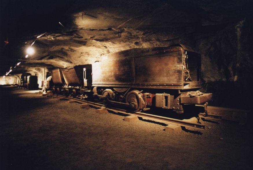
The most exciting event on this day was a visit to the old royal silvermine at
Kongsberg. It was founded in 1624 at contained one of the worlds most purest silver
deposits. The last mine closed in 1957. In the largest mine, the Kongsgruvene you take
a 2.3 km rail ride into the mountain. You can see a lot of equipment,lifts
(middle picture) and machines.
Now we go west towards the Telemark district. At Heddal we see another nice Stavkirke
and near ørvella we take a small detour and take the road to Gryta and follow
the east side of the Tinnsjø lake to Bakko, Rjukan and then towards Krokan.
At Vemork near Rjukkan the Germans build a heavy water plant during the Second World
War in order to build an atom bomb. Fortunately the Allied Forces knew about this
plan and set up Operation Grouse, one of the most daring sabotage missions of the
entire war.
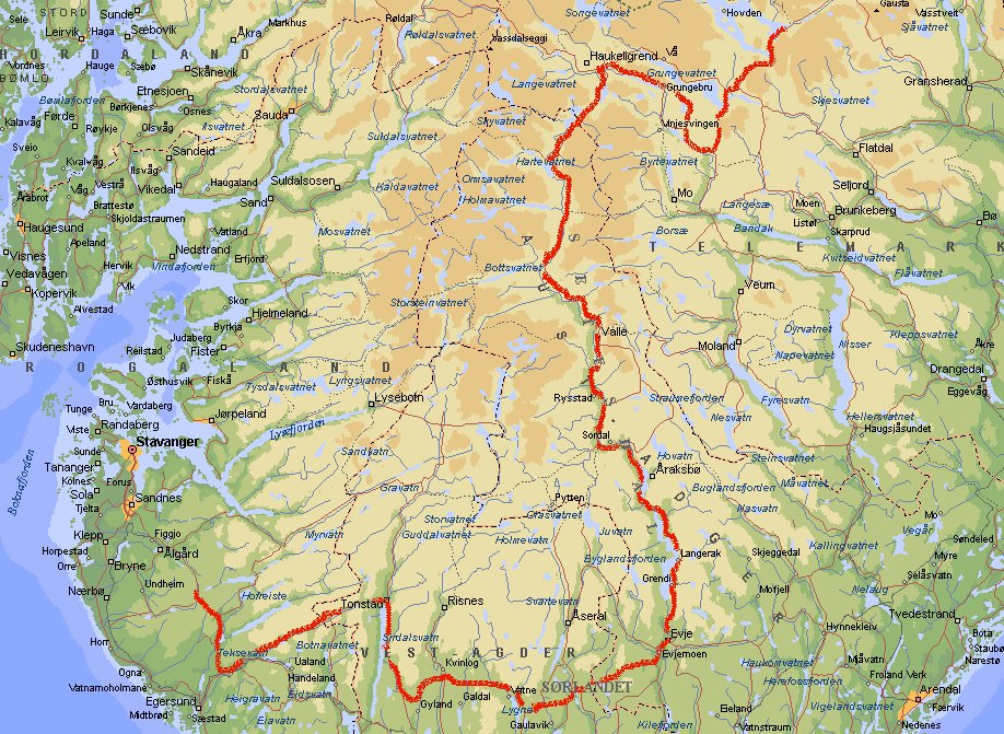
Day 28: Hössvasdammen - Søyland
(11680 km)
After a very quiet night just next to the dam we head for Åmot. There we
take the main road again Haukelrgrend. The goal is to go to Stavanger, but the
shortest route is not well suited for caravans. So we go south, all the way to
Evje. From there on it is west to Eiken, Tonstad and Helleland. At Søyland
we spend the night at the parking lot of a fast food restaurant.
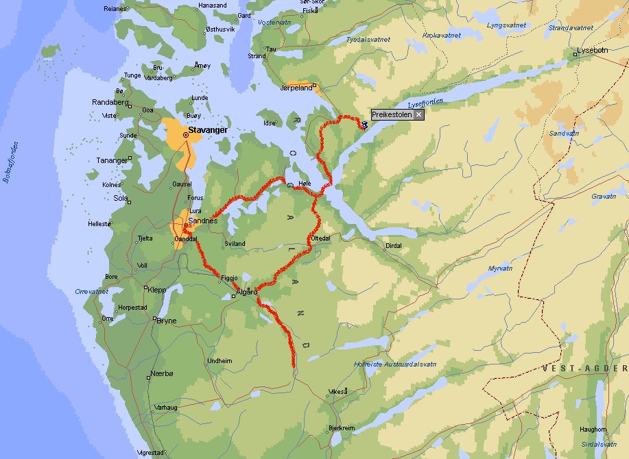
Day 29: Søyland - Preikestolen -
Søyland (12114 km)

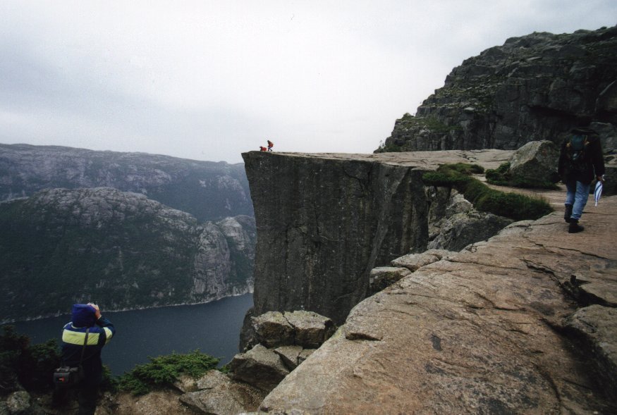
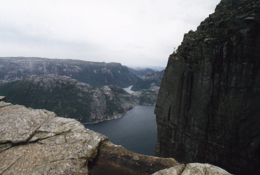
We follow the signs to Stavanger and at Sandness we turn towards Preikestolen.
At Lauvrik we take the ferry to Oanes (Nkr 99 one way) and after about 15 km we are ready
to start this famous hike.
Preikestolen (Pulpit Rock) is a granite rock going down 600 m into the fjord below
(Lysefjord). The walk is almost 2.5 hours going up. It was raining when we were
there, so the rocks were a bit slippery, but the view was great.
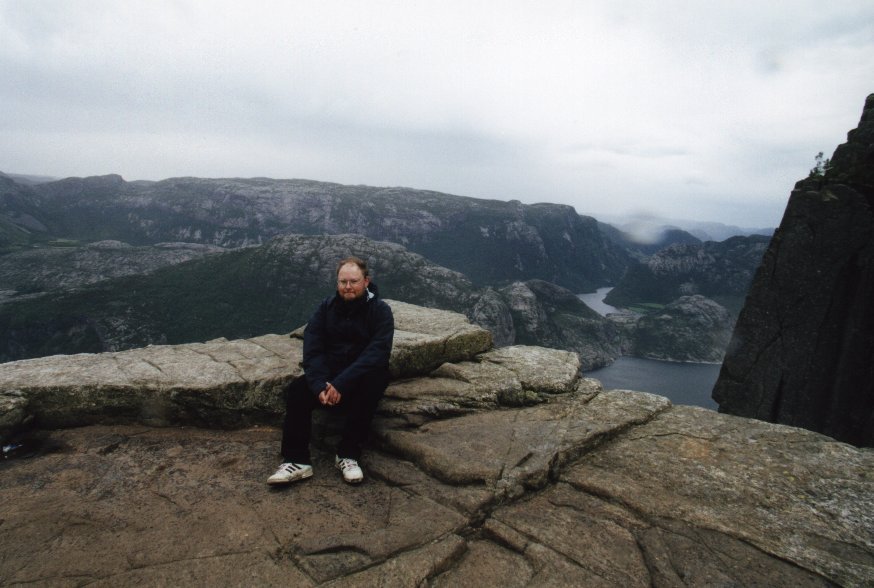
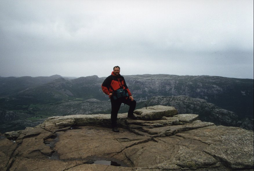 You can see us here right at the edge of the cliff. And yes, we looked a bit tired
already at this point. We still had more than two hours to walk back to the
carpark (which costs Nkr 80, just to park). We take the same road back and we also
end up spending the night at the same carpark as the day before.
You can see us here right at the edge of the cliff. And yes, we looked a bit tired
already at this point. We still had more than two hours to walk back to the
carpark (which costs Nkr 80, just to park). We take the same road back and we also
end up spending the night at the same carpark as the day before.
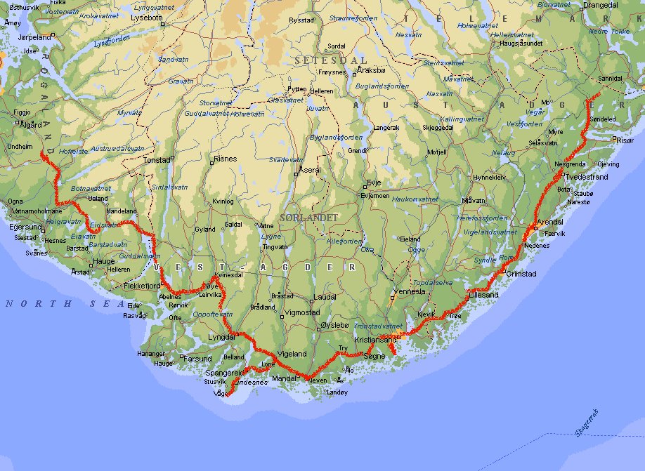
Day 30: Søyland - Østerholt
(12265 km)
At Helleland we take the road that follows the south coast of Norway and pass places
like Flekkefjord and Lyngdal. Near Vigeland we take the road to Lyndeness Fyr.
The southernmost point of Norway was very disappointing. According to the brochures
the lighthouse and the surrounding cliffs are fantastic, but we considered this
a boring place where you even had to pay to walk on the cliffs to see a very
small, not so fantastic lighthouse. Since we are Dutch, we didn't pay 30 kroner
just to walk on a cliff. So we return to the main road and go to Kristiansand.

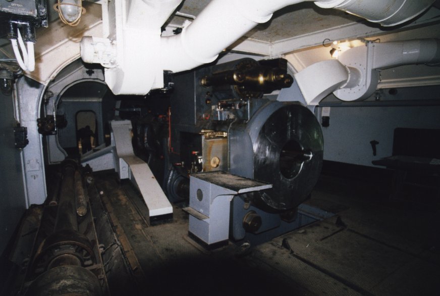 The Kristiansand Kanonmuseum at Movik holds the Germans' heavy Vara Battery. Together
with a similar cannon at Hanstholm in Denmark the Germans had almost complete control
of the strategic Skagerrak strait during the Second World War. There used to be four
337-tonne, 38 cm cannon with a range of 55 km. This was covered in two minutes.
The picture on the left showsthe inside of the cannon.
The Kristiansand Kanonmuseum at Movik holds the Germans' heavy Vara Battery. Together
with a similar cannon at Hanstholm in Denmark the Germans had almost complete control
of the strategic Skagerrak strait during the Second World War. There used to be four
337-tonne, 38 cm cannon with a range of 55 km. This was covered in two minutes.
The picture on the left showsthe inside of the cannon.
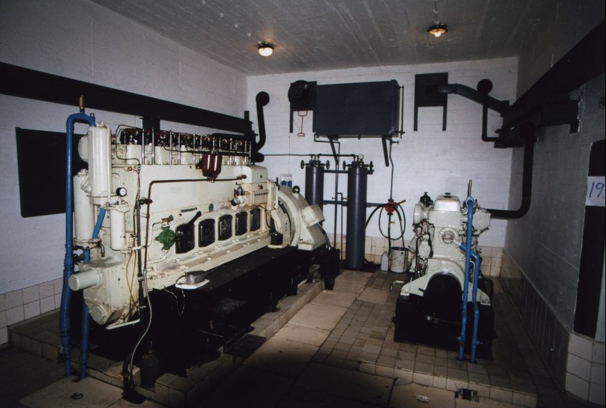
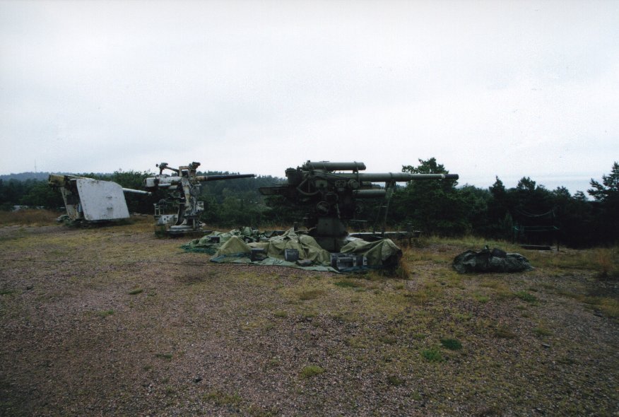 In the museum you can see big guns, bunkers, barracks, munitions storage (including
800 kg shells), power generators (these cannons needed a generator for themselves) and
all the other stuff that was needed to operate this site. The generator is visible
on the left.
In the museum you can see big guns, bunkers, barracks, munitions storage (including
800 kg shells), power generators (these cannons needed a generator for themselves) and
all the other stuff that was needed to operate this site. The generator is visible
on the left.
The journey continues and after passing Arendal we stop at Østerholt.
Day 31: Østerholt - Varberg (12664 km)
Following the coast to Larvik we drive in the direction of Oslo. At some point we
have to pay Nkr 15 toll, an unlikely low amount for Norway. But near
Tønsberg we leave the main road and head for Horten. There we take the ferry
to Moss (Nkr 263). Although I wanted to see a few things in Oslo it saves a few hours
and a several toll stations, although the price of the ferry is not cheap.
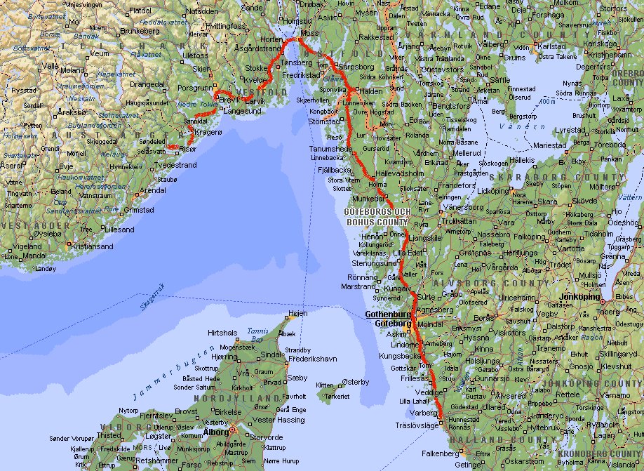
At Moss we go south-east towards Sarpsborg and Halden.
We enter Sweden again and follow part of the Bohuslän coastline and then drive to
Göteborg. This city was designed in 1621 by the Dutch. Since we don't have much time
we continue and stop near Varberg. The most interesting thing to visit Varberg is the
thirteenth century fortress at the seaside. It was home to the Swedish king Magnus
Eriksson, and important peace treaties with Denmark were signed here in 1343.
Day 32: Varberg - Emstek (13122 km)
The journey continues and we drive to Halmstad, Helsingborg and Malmö. Here we take
the new bridge back to Denmark. The Øresund Bridge between the two countries
is 17 km long. In fact it is a combination of a bridge and a tunnel connected on a
man-made island in between. Due to the hight of the bridge there is a strong wind
noticeble when you are driving. I couldn't find a nice place to stop and make a picture.
Crossing the bridge with caravan costs Dkr 500.
Then we follow the same route back as we started this holiday. Driving along the islands
Fyn (damned toll of Dkr 340 again) and Sjælland we come back at Jutland near
Fredericia and Kolding. We follow the signs to Flensburg (Germany) and then to Hamburg
and Bremen. There it starts raining and after a few hours we stop in the evening at
Emstek.
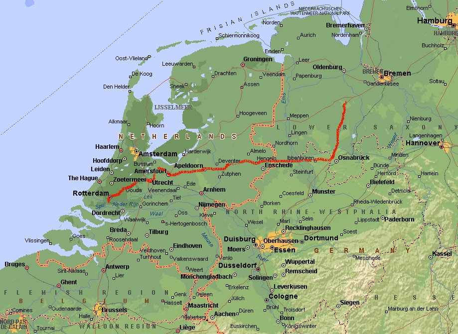
Day 33: Emstek - Ridderkerk (14359 km)
We are almost home now, but it is still about 5 hours to drive. The weather is much better
than the day before and we pass Osnabrück and cross the border at Oldenzaal. Via
Apeldoorn and Utrecht we drive to Rotterdam and finally Ridderkerk. After 5 weeks and
14359 km we are back home. Unpack the car and clean the caravan! I think we deserve a
rest after this huge journey.
This document was last updated on 13/08/00