

| Holiday 1999 in Alaska and Yukon |
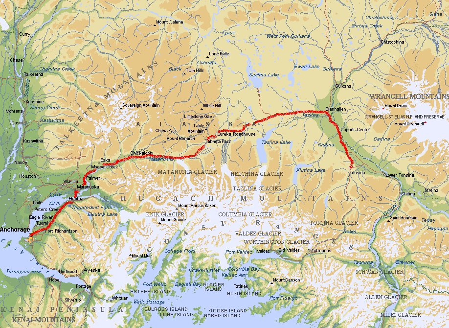
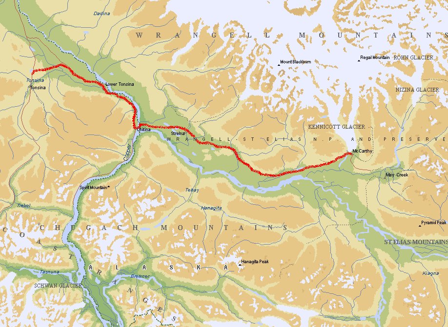
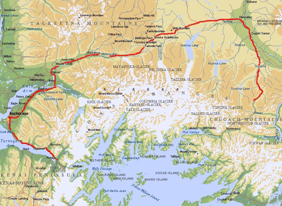
Anchorage - Tonsina
You take the Glen Highway (Highway 1) to Glennallen and then Highway 10.
The first place we visited was near Tonsina. It is close to Wrangell - St. Elias, the largest
National Park in Alaska (6 times as large as Yellowstone) and contains 4 mountains above
4000 m. There are two roads in the park and we took the one in the west. There is also a
road in the north side.
Tonsina - McCarthy
 Remember that the road going to McCarthy is called 'the worst road
in Alaska'.
Beginning at the Copper River and ending at the Kennicott River, the McCarthy Road spans
approximately 58 miles. For the most part, it follows the roadbed of the Copper River and
Northwestern Railroad which was constructed between 1908 and 1911. For 27 years the
196 mile railway carried copper from the historic Kennicott mining area to the coast at
Cordova. The last train pulled into Cordova on November 11, 1938. What is now called the
McCarthy Road is a portion of that momentous construction project! Basically the road is just some gravel put on top of the old railroad path. This
means that on some points you can still see the wood of the track and sometimes nails are
sticking out out the ground. This will rip your tires apart if you are unlucky.
Remember that the road going to McCarthy is called 'the worst road
in Alaska'.
Beginning at the Copper River and ending at the Kennicott River, the McCarthy Road spans
approximately 58 miles. For the most part, it follows the roadbed of the Copper River and
Northwestern Railroad which was constructed between 1908 and 1911. For 27 years the
196 mile railway carried copper from the historic Kennicott mining area to the coast at
Cordova. The last train pulled into Cordova on November 11, 1938. What is now called the
McCarthy Road is a portion of that momentous construction project! Basically the road is just some gravel put on top of the old railroad path. This
means that on some points you can still see the wood of the track and sometimes nails are
sticking out out the ground. This will rip your tires apart if you are unlucky.
In the park you can visit Kennicott, an old mining town that was abandoned in 1938.
Because the Kennicott Copper Corporation couldn't compete with the falling prices of
copper, they closed the mine down.
McCarthy - Tetlin Junction
 Then we drove back to Chitina and then to Tok. This is not an exciting place, but
there you can get a lot of supplies. Unfortunately you can not get a pressure valve for
a Coleman gas stove. In Tok you can go several directions, because Highway 1 and 2 are
crossing at this point. We went to Beaver Creek (border of USA and Canada), following
the Alaska Highway. At Tetlin Junction we stayed on a campground where we had our
first experience with nasty mosquitoes.
Then we drove back to Chitina and then to Tok. This is not an exciting place, but
there you can get a lot of supplies. Unfortunately you can not get a pressure valve for
a Coleman gas stove. In Tok you can go several directions, because Highway 1 and 2 are
crossing at this point. We went to Beaver Creek (border of USA and Canada), following
the Alaska Highway. At Tetlin Junction we stayed on a campground where we had our
first experience with nasty mosquitoes.
Tetlin Junction - Haines Junction
 Then we went southwards to Haines Junction. It was impossible to walk in the woods without
protection against mosquitoes so here we bought a spray with DEET. This really helps a
lot. The bugs still circle around you but they keep a distance. Remember that the spray
does not help to protect you from bears. So watch out when you are hiking in woodland
area's.
Then we went southwards to Haines Junction. It was impossible to walk in the woods without
protection against mosquitoes so here we bought a spray with DEET. This really helps a
lot. The bugs still circle around you but they keep a distance. Remember that the spray
does not help to protect you from bears. So watch out when you are hiking in woodland
area's.
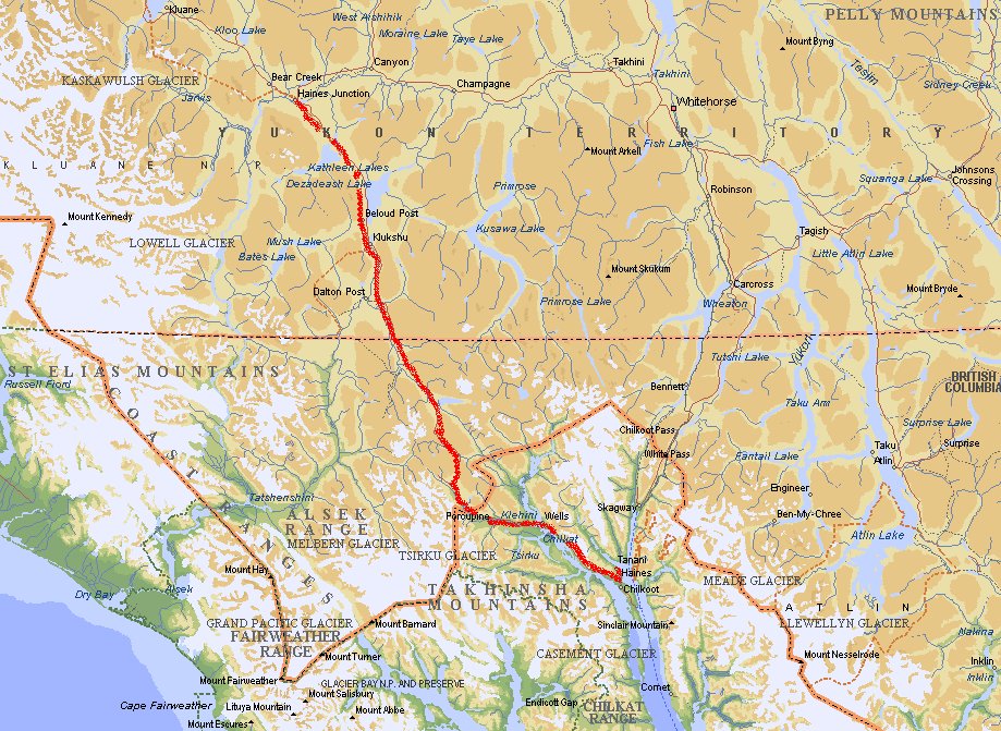
Haines Junction - Haines

 Haines is a community rich in Tlingit Native culture and is best known for its majestic
mountain scenery, king and sockeye salmon-fishing, native art and dance and the newly
created Chilkat Bald Eagle Preserve. At Haines the road stops and you'll have to take
the ferry to Skagway.
Haines is a community rich in Tlingit Native culture and is best known for its majestic
mountain scenery, king and sockeye salmon-fishing, native art and dance and the newly
created Chilkat Bald Eagle Preserve. At Haines the road stops and you'll have to take
the ferry to Skagway.
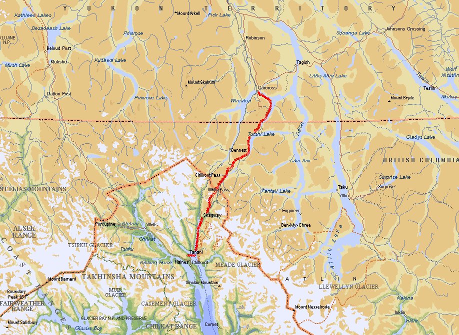
Haines - Skagway - Carcross
Keep in mind that Skagway is populated by people who are not Alaskans,but
live in the lower 48. This place is only nice for tourists who like non-authentic shops
and want to buy beads and stuff like that. Am I being a bit cynical here?
Near Carcross we stayed the night at the Spirit
Lake Wilderness Resort (Mile 72.3 on the
Klondike Highway). This place is owned by a friendly Dutch family.
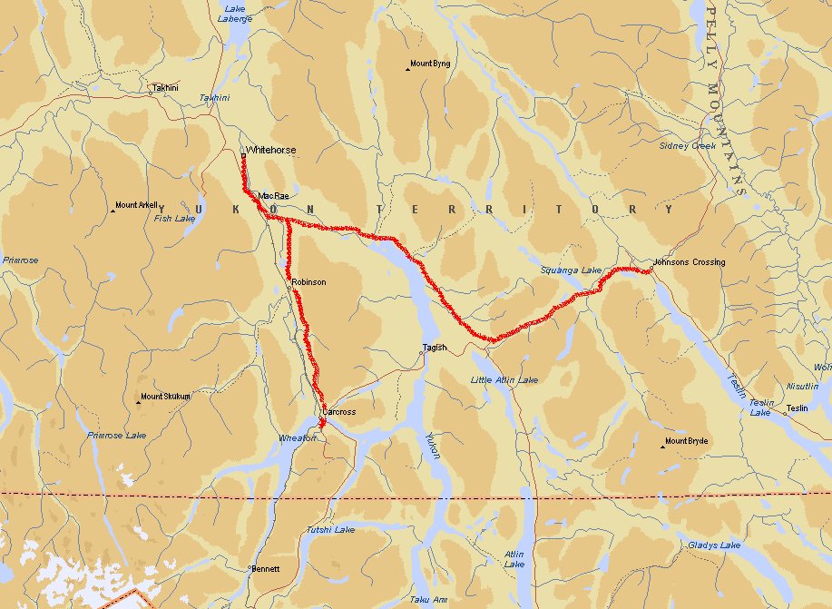
Carcross - Whitehorse - Johnsons Crossing
 We went further to Whitehorse, the largest city in Yukon. Two-third of the population of
Yukon live here (18.000 people). It is situated along the Yokun River. Here we found our pressure valve. During the Klondike Gold Rush (1897-1898) Whitehorse was an important
supply centre for fortune seekers and golddiggers who were on their way to Dawson City.
After visiting Whitehorse we took Highway 1 to Johnsons Crossing.
We went further to Whitehorse, the largest city in Yukon. Two-third of the population of
Yukon live here (18.000 people). It is situated along the Yokun River. Here we found our pressure valve. During the Klondike Gold Rush (1897-1898) Whitehorse was an important
supply centre for fortune seekers and golddiggers who were on their way to Dawson City.
After visiting Whitehorse we took Highway 1 to Johnsons Crossing.
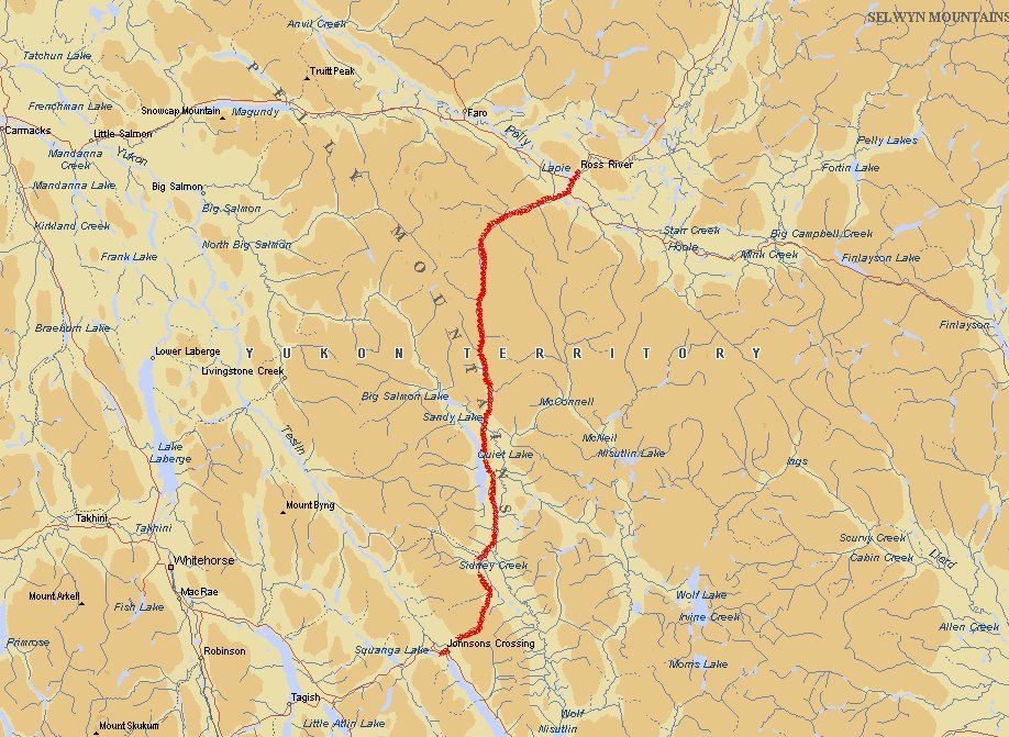
Johnsons Crossing - Ross River
 At this point we took the South Canol Road (Highway 6) towards Ross
River. Because there are no services for 226 km please buy supplies (food for at least 3 days) and a full tank of gas before you start. The trip takes one day, but if you get
stuck, you can better be prepared. Also check your spare tire.
At this point we took the South Canol Road (Highway 6) towards Ross
River. Because there are no services for 226 km please buy supplies (food for at least 3 days) and a full tank of gas before you start. The trip takes one day, but if you get
stuck, you can better be prepared. Also check your spare tire.
The Canol Road is 495 km long. This gravel road was build during the Second World War for
the maintenance of an oil pipeline from Norman Wells in the Northwest Territories to the
city of Whitehorse. Nowadays the pipeline is no longer in use. Both the North and the South
part of the road are open in summer. The Canol Road goes through beautiful mountainous
wilderness and lots of lakes are rivers.
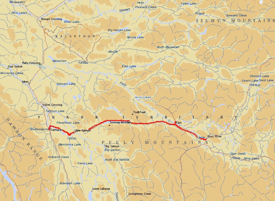
Ross River - Carmacks
In Ross River you can buy gas again. This is also the place where you can repair your tires.
Here we had our first flat tire. There is no campsite in Ross River (only an RV park), but
it is allowed to camp close to the river (near the ferry) next to the baseball park.
The Robert Campbell Highway (Highway 4) lies in a virgin wilderness in the south-east part
of Yukon. You will pass the mining city Faro (the youngest city in the Yukon Territory -
1700 inhabitants). It was build in 1969 for the miners working in the Cyprus Anvil mine.
This is the largest leadmine in Canada.
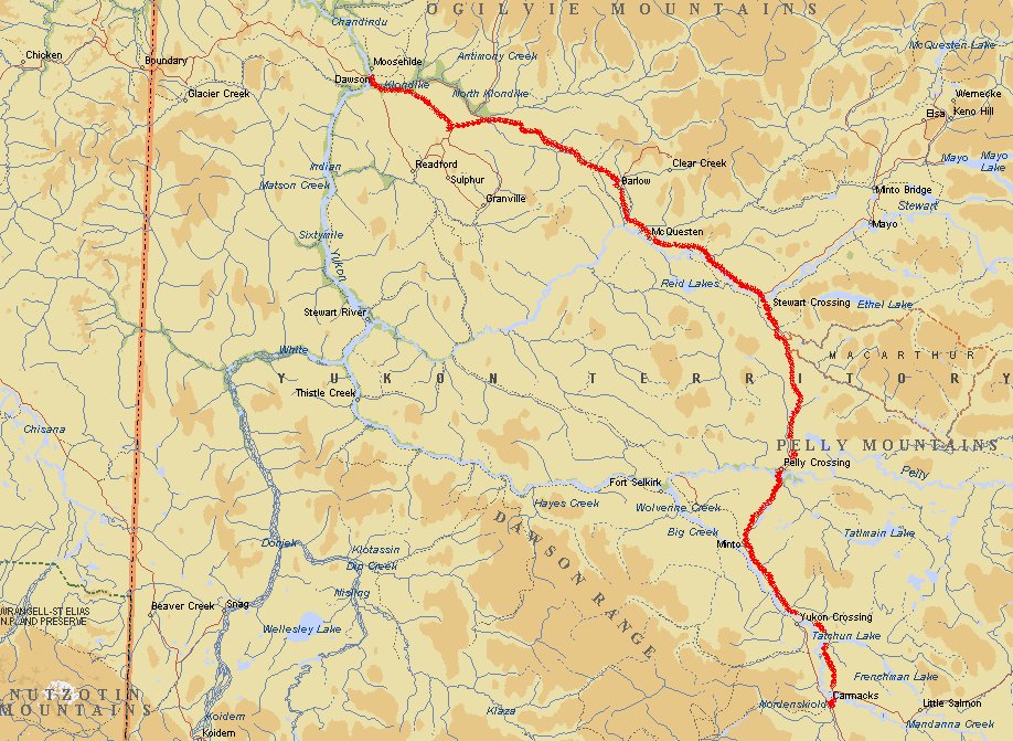
Carmacks - Dawson
 Dawson City was the place to be during the Klondike Goldrush. You will find a lot of historical sites and buildings here. Dawson was a boom town where the fabulously rich
and the dirt poor walked the same wooden planks over the marshy streets. Despair was
everywhere except in the dance halls, saloons and shops.
Dawson City was the place to be during the Klondike Goldrush. You will find a lot of historical sites and buildings here. Dawson was a boom town where the fabulously rich
and the dirt poor walked the same wooden planks over the marshy streets. Despair was
everywhere except in the dance halls, saloons and shops.
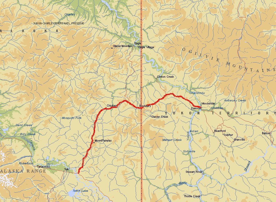
Dawson - Tetlin Junction
This road (Taylor Highway or Highway 9) is only opened in summer. The terrain is rugged
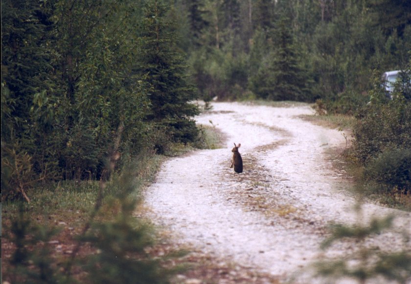
and the road gets worse when you cross the border near a place called Boundary. The nature
here is very nice. Lots of small animals and birds.
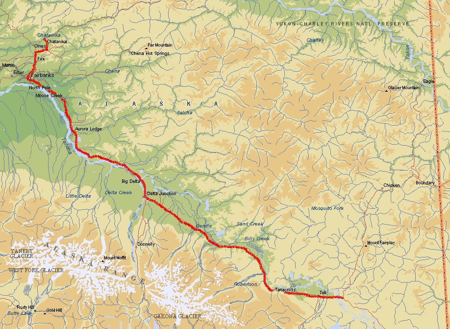
Tetlin Junction - Upper Chatanika River
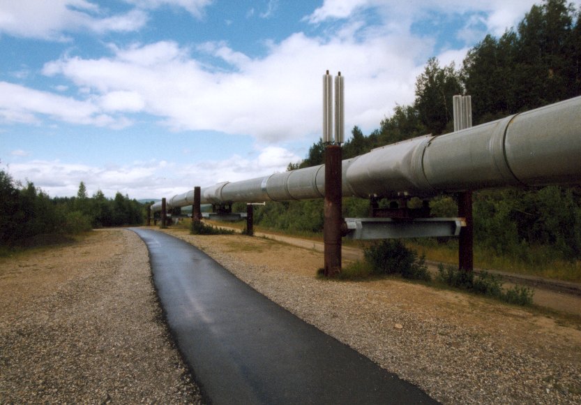 You follow the Alaska Highway (Highway 2) in northern direction towards Fairbanks. You cross
the Alaska pipeline here. At some points you can see it very well. Near Big Delta there is
a bridge made for the pipeline. Further north lies North Pole, home of Santa Claus.
You follow the Alaska Highway (Highway 2) in northern direction towards Fairbanks. You cross
the Alaska pipeline here. At some points you can see it very well. Near Big Delta there is
a bridge made for the pipeline. Further north lies North Pole, home of Santa Claus.
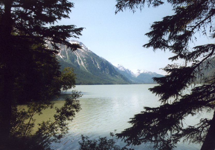
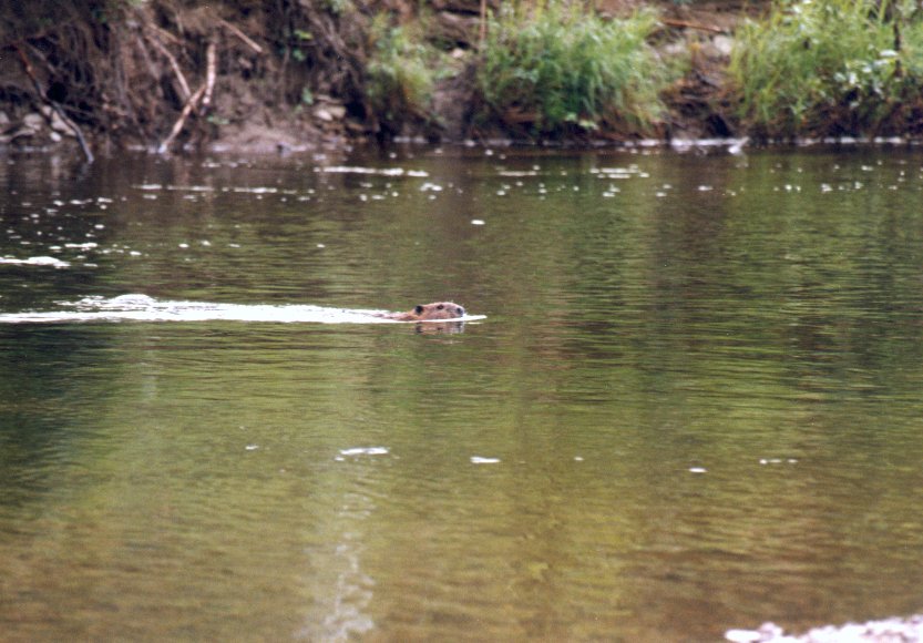
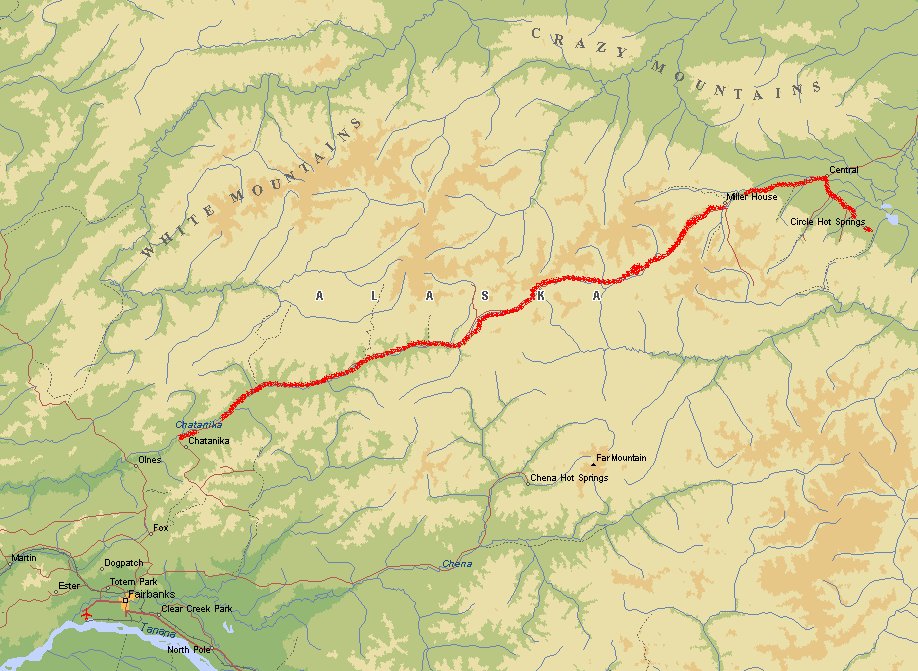
North of Fairbanks lies the White Mountains. We took Highway 6 (Stesse Highway) to wander
off in this quiet recreation park. Here we spotted bald eagle and beaver.
Upper Chatanika River - Circle Hot Springs - Upper Chatanika River
 We were very disappointed when we arrived at Circle Hot Springs. There is only a small hotel
that is build around the hot springs. Not the kind of hot spring that I have seen elsewhere.
Bummer! But the road to this place is very nice.
We were very disappointed when we arrived at Circle Hot Springs. There is only a small hotel
that is build around the hot springs. Not the kind of hot spring that I have seen elsewhere.
Bummer! But the road to this place is very nice.
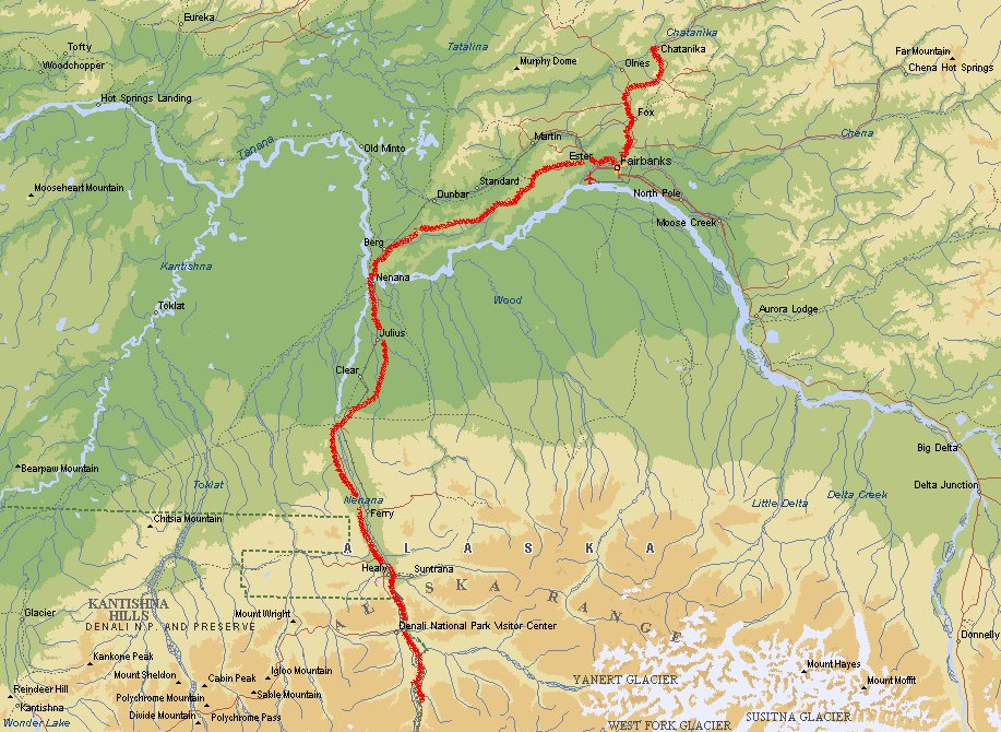
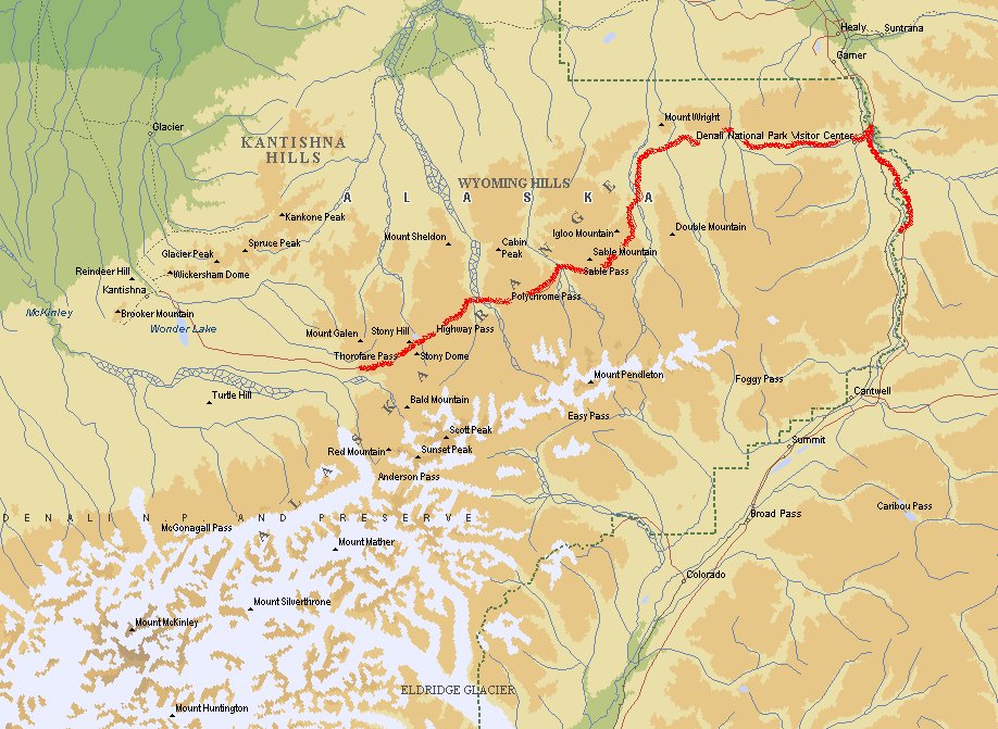
Upper Chatanika River - Denali
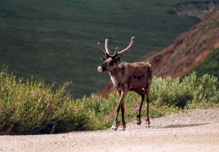
It was raining the whole day when we drove this part. But even when it rains it is a
fantastic scenery when you encounter Denali National Park. You haven't been to Alaska
when you didn't see Denali. It is best to make reservations when you want to enter the park.
To protect wildlife viewing opportunities, limits are set on park road traffic, including
buses. Expect delays getting out into the park during the peak season. Denali is a true
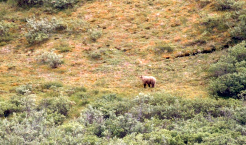
wilderness. Before venturing into park, read the safety articles in Denali Alpenglow,
the park newspaper. Grizzly bears and moose are dangerous. Crossing glacial rivers is
trecherous.
Denali

Denali, the "High One", is the name Athabascan native people gave the massive peak that
crowns the 600-mile-long Alaska Range. Denali is also the name of an immense national
park and preserve created from the former Mount McKinley National Park. The changes in
names and boundaries that have occured over the years can be confusing, as they indicate
the way various parts of the park and preserve may be used today. In 1917 Mount McKinley
National Park was established as a game refuge. The park and the massif including North
America's highest peak were named for former senator - later President - William McKinley.
In 1980, the Alaska National Interest Lands Conservation Act (ANILCA) enlarged the boundary
by 4 million acres and redesignated it as Denali National Park and Preserve. At 6 million
acres, the park is larger than Massachuchetts. It exemplifies interior Alaska's character
as one of the world's last great frontiers for wilderness adventure. It remains largely
wild and unspoiled, as the Athebascans knew it. Denali National Perk and Preserve is
managed as three distinct units. Denali Wilderness, most of the former Mount
McKinley National Park, is managed to maintain the undeveloped wilderness parkland
character. Backcountry use is regulated and most traditional national park regulations
apply here. Denali Wilderness is closed to sport and subsistence hunting and trapping
activities. Denali National Park additions, established by ANILCA in 1980
(excluding Denali WIlderness), allow customary and traditional subsistence uses by
local rural residents. This recognizes the longstanding dependance on wildlife,fish and
plant materials for subsistence in rural Alaska. Denali National Reserve allows
subsistence uses and also allows sport hunting, trapping and fishing under Alaska Fish
and Game regulations. There are two such preserve areas.
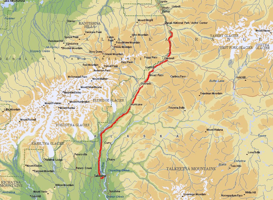
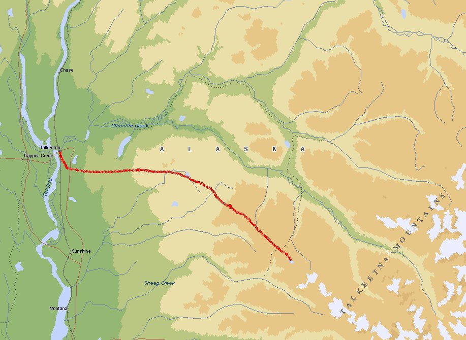
Denali - Talkeetna
After an impressive tour in Denali we went southwards along the George Parks Highway
(Highway 3) to Talkeetna. At this place we would be picked up by a pilot to bring us
into the Alaska Bush. Due to bad weather we were unable to fly on the arranged day.
Talkeetna - Caribou Lodge
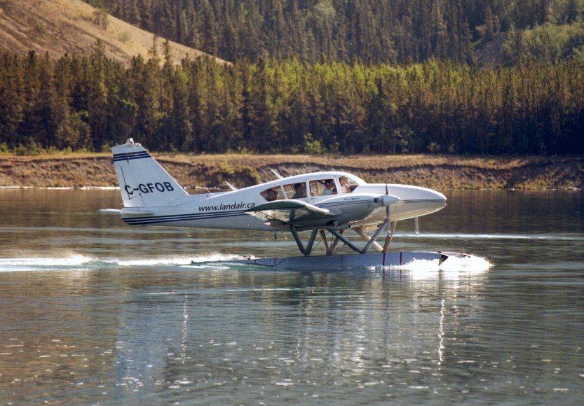
 The next day was better, so Elbert (the pilot) took us to Caribou Lodge. This was my
first experience with a Chessna float plane.
The next day was better, so Elbert (the pilot) took us to Caribou Lodge. This was my
first experience with a Chessna float plane.
It was still cloudy and a bit windy, but Elbert is an experienced pilot, not a
risky pilot. He will only fly when it is safe.
Caribou Lodge
 Caribou Lodge is located on a remote lake above timberline in the Talkeetna Mountains just
southeast of Denali National Park and east of Talkeetna. Nature and tranquility are your
only neighbors. The lodge offers fantastic views of Mount McKinley and the Alaska Range
to the west and to the east overlooking the lake, stands the beautiful Talkeetna
Mountains.
Caribou Lodge is located on a remote lake above timberline in the Talkeetna Mountains just
southeast of Denali National Park and east of Talkeetna. Nature and tranquility are your
only neighbors. The lodge offers fantastic views of Mount McKinley and the Alaska Range
to the west and to the east overlooking the lake, stands the beautiful Talkeetna
Mountains.
You can view wildlife, observe the flora and fauna, ply your lens in unlimited photography
opportunities, or take a leisurely boat ride around the lake and try your hand at catch
and release fishing.
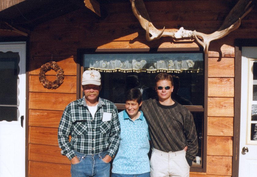
Mike and Pam with their son Aaron call Caribou Lodge their home and live there year around.
All supplies are flown-in by bush plane equipped with floats in summer and skis in for
landing on the frozen lake in winter. For the two-to-three months of the year during
winter "freeze-up" and "spring break-up", they are isolated in the wild Alaskan Bush.
Aaron is home-schooled which occupies many of the short days and long nights of winter.
There experiences of living the dream that most of us have had at one time or another,
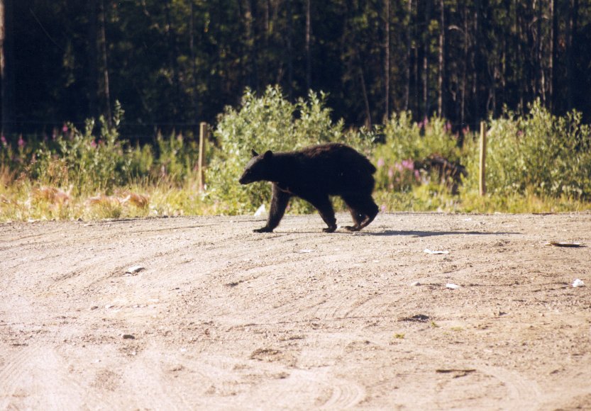
varies from having grizzly bears out the front door, to long winter nights by a warm fire
with a good book while the aurora borealis dance overhead, to surprise visits from
traveling wolves.
Caribou Lodge - Talkeetna - Lake Nelchina
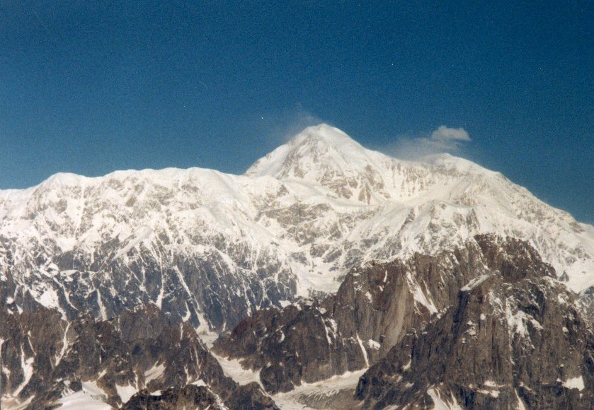 After spending three days at Caribou Lodge at was time to go. The weather was exceptional
good and Mount McKinley and the rest of the Alaska Range was out there without a patch of
clouds. Elbert called and asked if we were interested in a scenic flight around McKinley.
Without hesitating I said YES, I didn't even ask what the price was - who cares. I knew
that this kind of weather was rare. McKinley without clouds happens only in 5 percent
of all days. This was a once in a lifetime experience.
After spending three days at Caribou Lodge at was time to go. The weather was exceptional
good and Mount McKinley and the rest of the Alaska Range was out there without a patch of
clouds. Elbert called and asked if we were interested in a scenic flight around McKinley.
Without hesitating I said YES, I didn't even ask what the price was - who cares. I knew
that this kind of weather was rare. McKinley without clouds happens only in 5 percent
of all days. This was a once in a lifetime experience.
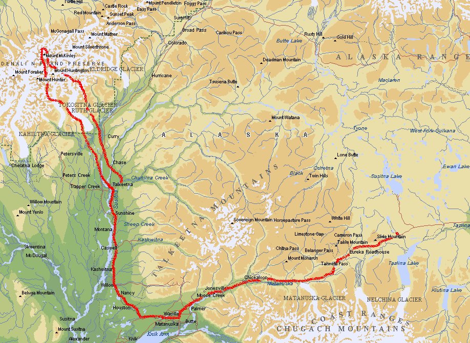
Lake Nelchina - Valdez - Little Tosina
 Most part of this route was known by us, because we drove it 20 days ago (from Palmer
to Tonsina). We had the plan to take a boat from Valdez to Whittier (Marine Highway) and
then the train to Portage, but
since we didn't make any reservations we found out at Valdez that there was no place
for us on the boat for the next few days. Bummer again! So we missed a trip through
the Prince William Sound and had to drive back to go to the Kenai Fjords.
Most part of this route was known by us, because we drove it 20 days ago (from Palmer
to Tonsina). We had the plan to take a boat from Valdez to Whittier (Marine Highway) and
then the train to Portage, but
since we didn't make any reservations we found out at Valdez that there was no place
for us on the boat for the next few days. Bummer again! So we missed a trip through
the Prince William Sound and had to drive back to go to the Kenai Fjords.
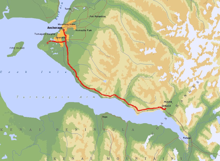
Little Tosina - Portage Valley
Hey, this part we have seen already twice. But the scenic view of the Chugach Mountains
and Matanuska Peak are nice time after time. At Palmer you take the Old Glenn Highway
(Highway 1) to Anchorage. Follow the Minnesota Drive and take the Seward Highway
(Highway 1). On your right side you'll see the Cook Inlet, Chickaloon Bay and Turnagain
Arm. It can be quite windy here. If you follow the road to Portage Glacier you'll see
several campsites.
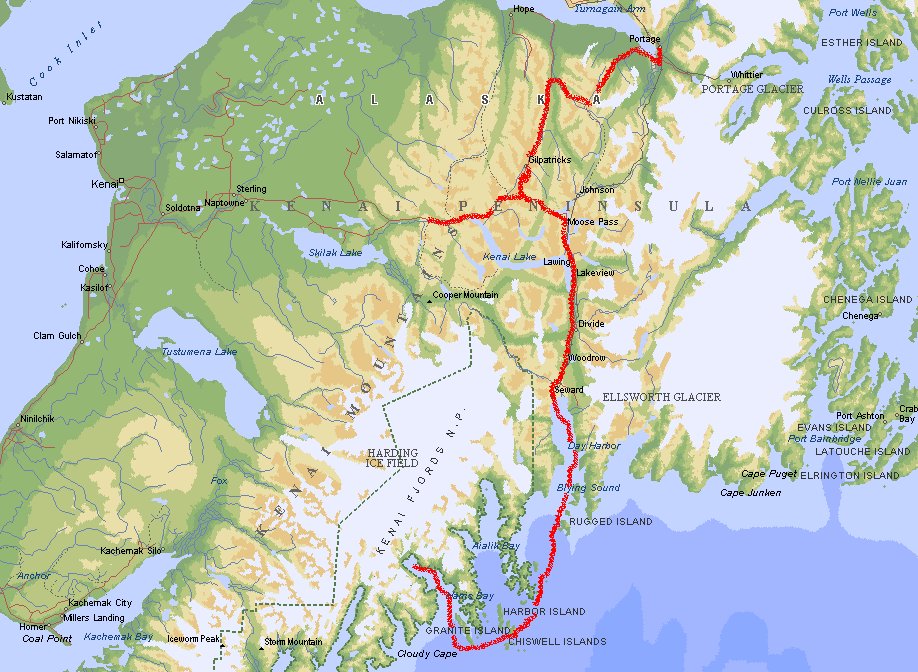
Portage Valley - Seward - Cooper Landing
 Seward, founded in 1903, was for years the leading port city of Alaska. It was eventually
eclipsed in that role by Anchorage, and the 1964 earthquake devastated the economy. Twenty years later, it began to regain its financial legs and is once again a thriving port.
Seward, founded in 1903, was for years the leading port city of Alaska. It was eventually
eclipsed in that role by Anchorage, and the 1964 earthquake devastated the economy. Twenty years later, it began to regain its financial legs and is once again a thriving port.
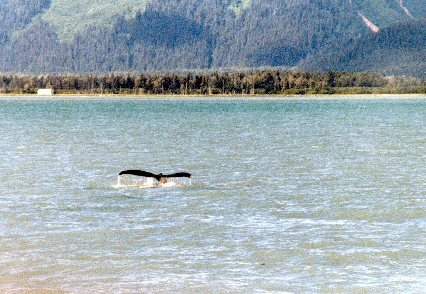
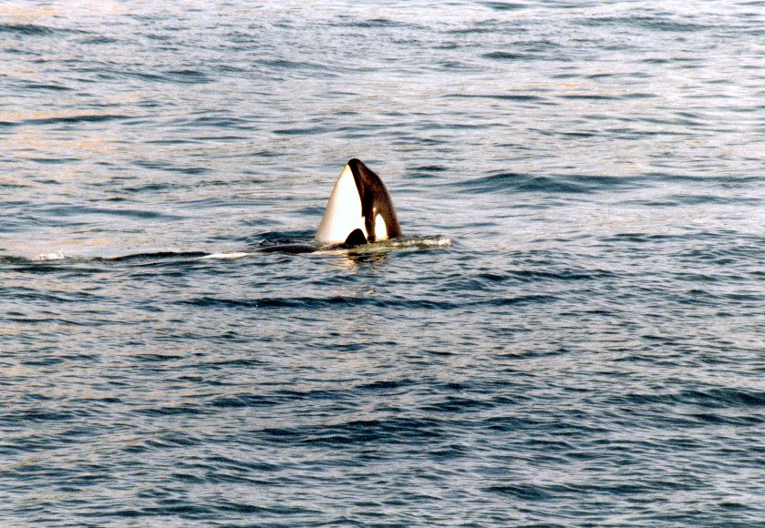
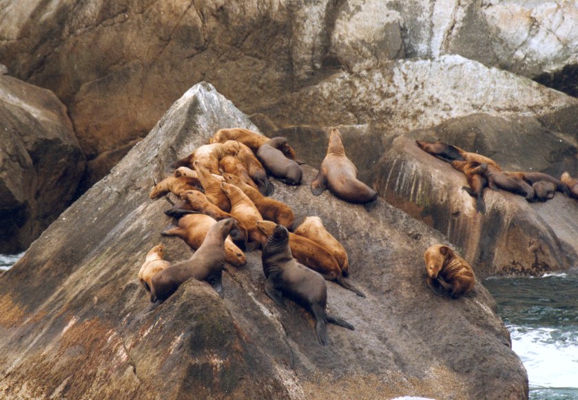
At Seward we made a boat trip of 6 hours along the Kenai Fjords. Here you can see Bald
Eagles, Orca's, Humpback Whales, Stellar Sea Lions, Harbor Seals, Puffins, Black Oyster
Catchers, Cormorants, Kittiwakes, Murres and lots of other wildlife.
The boat took us al the way to Aialik Glacier, a tidewater glacier. The thunderous
boom of calving ice can sometimes be heard 20 miles away.
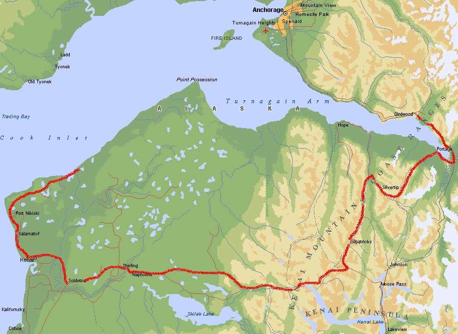
Cooper Landing - Homer - Kenai
Today we explore the rest of the peninsula. The drive to Homer was a bit dull because
it was rainy and we could barely see the land at the other side of the Cook Inlet. That's
really sad, because you'll have a splendid view of Aleutian Range with mountains of
11,000 feet high. Homer was not my idea of a nice place. Maybe because I don't like
fishing together with a few thousand other people. In fact, I don't like fishing at all.
We headed north along the Cook Inlet and ended up at the Captain Cook Recreational Site.
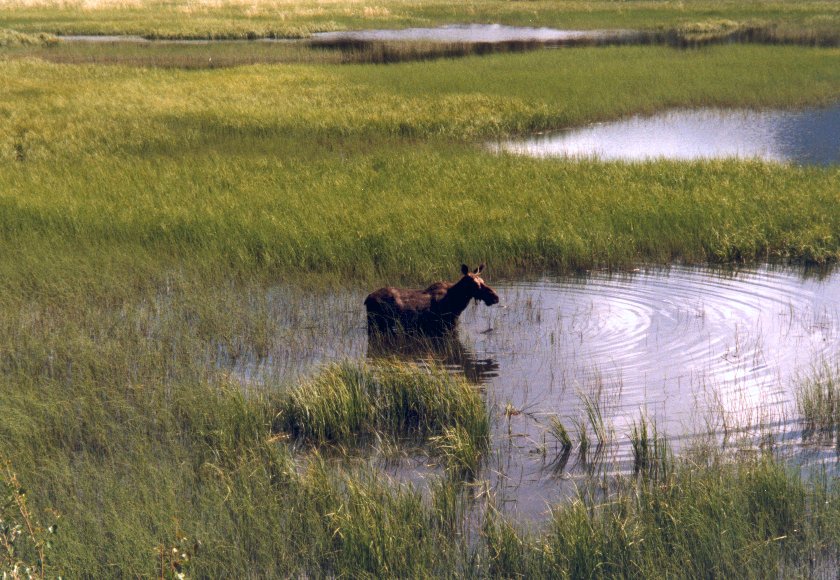
This is a remote area with lots of wildlife. Moose and Bear country. We had our second
flat tire here.
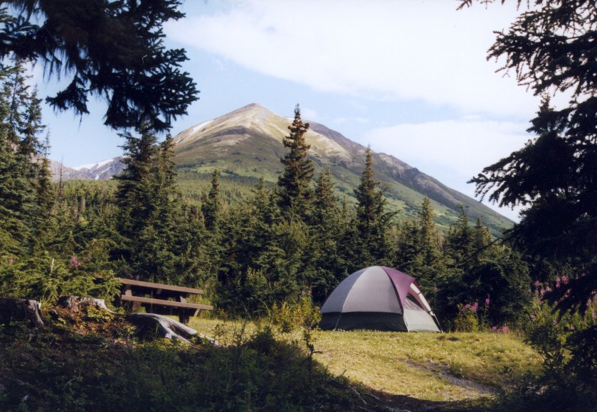
Kenai - Tenderfoot Creek
Today we took out flat tire to a garage. It was difficult to find the problem. After about
an hour we were back on the road again. Doing our last shopping in Kenai and drive to
Exit Glacier. The glacier connects to the Harding Icefield, a nearly flat 50-mile by
30-mile expanse of snow and ice which covers all but the peaks of the Kenai
Mountains.
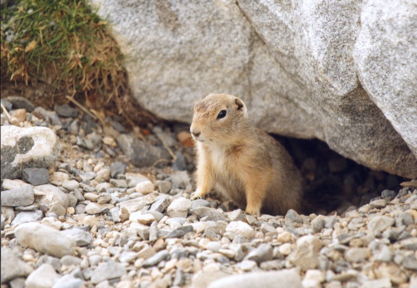
We stopped in the
early afternoon at a campsite. Nice and quiet place. A squirrel was very keen on our
food supply. He licked our plates clean after we had dinner and jumped on my shoulder
and head. What a character.
Tenderfoot Creek - Anchorage
 Driving back to Anchorage to the car rental. We had to bring the car back at 3 o'clock
in the afternoon. They drove us to the airport where we had to wait until 1 a.m. for
our flight back home. And there is nothing you can do at the Anchorage Airport.
Driving back to Anchorage to the car rental. We had to bring the car back at 3 o'clock
in the afternoon. They drove us to the airport where we had to wait until 1 a.m. for
our flight back home. And there is nothing you can do at the Anchorage Airport.
Anchorage - Amsterdam
The cheapest flight is not the easiest route. So we went to Seattle, Atlanta and then to
Amsterdam. We are back home after 30 days.
This document was last updated on 15/08/00